


DENVER — The heat was on this Memorial Day weekend! And the 70s and 80s and a few scattered storms will stick around this week.
- Watch Danielle Grant's full forecast in the video player below.
Look for a few lingering gusty showers this evening but most areas along the Front Range will stay dry. Mostly cloudy skies become mostly clear early Tuesday as temperatures drop into the mid-50s overnight.
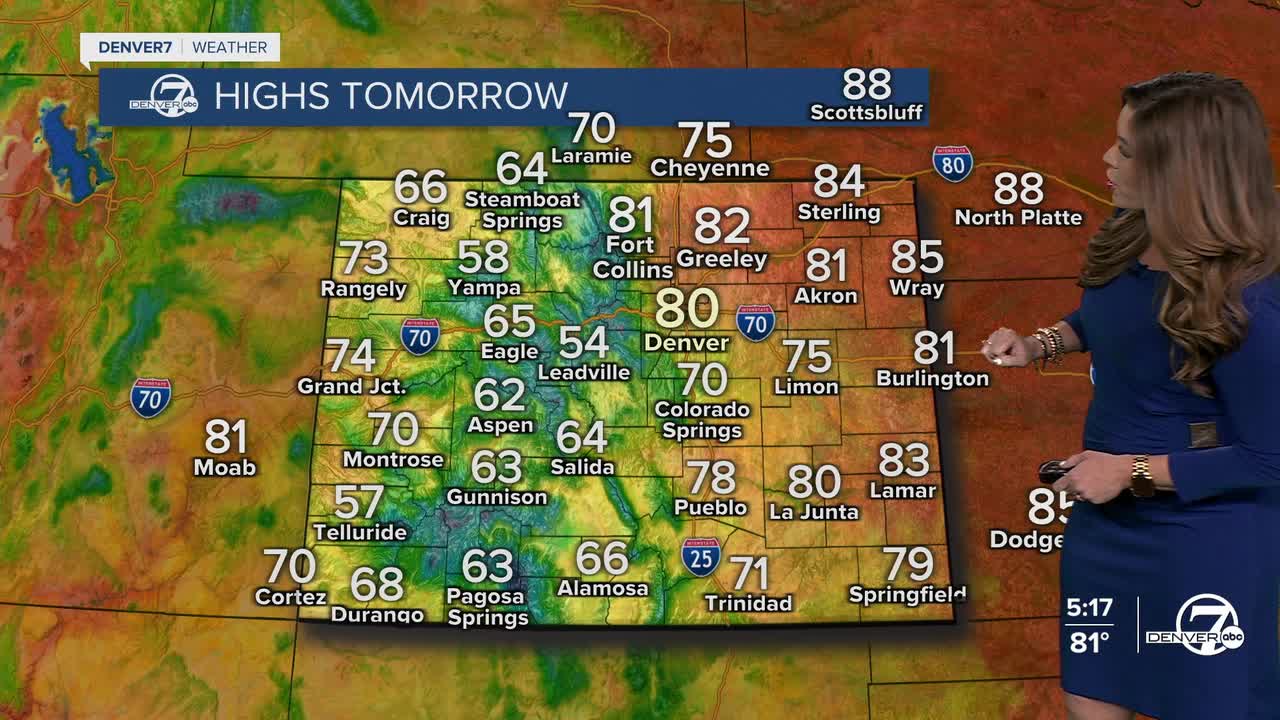
We'll see increasing clouds throughout the afternoon but that won't stop temperatures from soaring into the upper 70s to low 80s. The Denver metro area could see a few gusty storms in the afternoon but they'll mainly bring wind rather than rain.
Right now, Wednesday appears to be the most active weather day of the week, with more widespread showers and thunderstorms expected across the entire state. Daytime highs will be a bit cooler in the mid-70s with mostly cloudy skies throughout the entire day. So far, it looks like general thunderstorms with limited severe cells statewide.
We'll see a few storms pop up Thursday and Friday with more isolated storms Saturday. It looks like potentially another round of more widespread storm activity is possible this Sunday. Stay tuned as it gets closer!
DENVER WEATHER LINKS: Hourly forecast | Radars | Traffic | Weather Page | 24/7 Weather Stream
Click here to watch the Denver7 live weather stream.
