


DENVER — After a cooler Sunday thanks to a weak front and a little mountain snow, we’ll flip the script quickly to start the workweek. Monday will be warm and dry across much of the area, with highs climbing into the lower 70s on the plains and through the urban corridor.

That’s quite a jump from the weekend and even close to record territory in a few spots. With warmer air and a bit of a breeze mixing down from above, parts of the Palmer Divide could see gusts around 25 to 30 mph, leading to higher fire danger there.

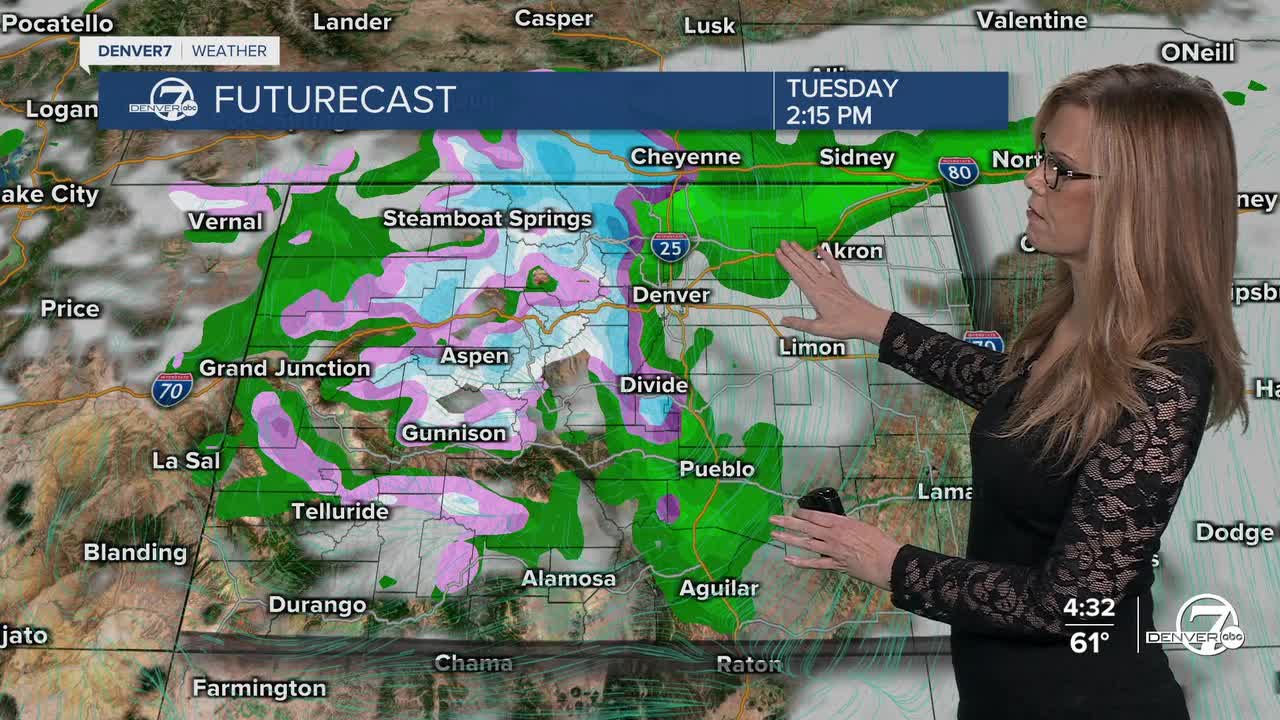
Clouds will increase Monday night as the next system moves in. Snow showers are likely in the mountains overnight, and there’s a strong chance that we’ll see measurable snow in the mountains by Tuesday. The best chances look to be north of Interstate 70, where the storm track is expected to focus most of the moisture.
For the lower elevations, this system looks more like a rain event during the day Tuesday. Temperatures should be warm enough to limit snow accumulation on the plains, though a brief rain-snow mix can’t be ruled out late in the day across the northeast plains and possibly the Palmer Divide. Rain totals on the plains should generally range from about a tenth to three-tenths of an inch. In the northern mountains, snowfall totals of 2 to 6 inches are possible, though small shifts in the storm’s track could change those numbers.
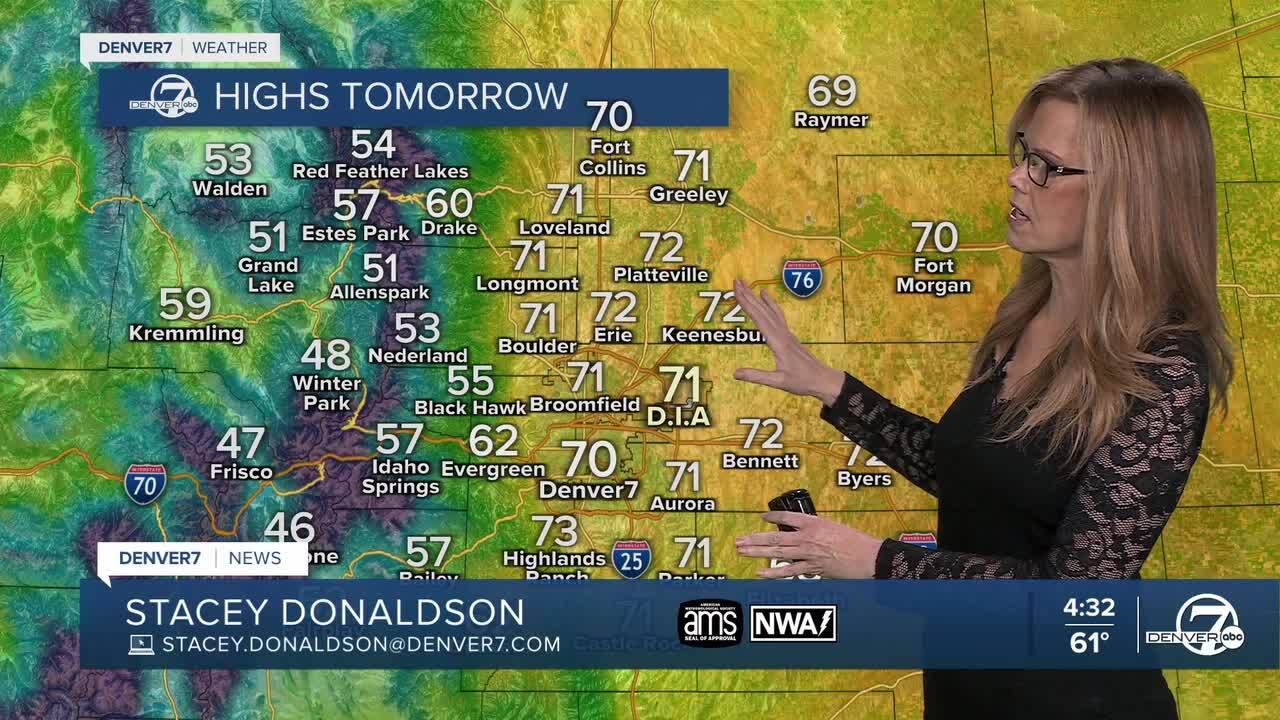
Wednesday into early Thursday brings a break. We’ll dry out and warm back up, with highs returning to the 60s for many lower elevation areas. It should be a fairly quiet stretch of weather and a good chance to catch your breath before the next round moves in.
Looking ahead to late Thursday night through Friday, a colder and more complicated storm system is expected to develop. There’s growing potential for more widespread snow, including lower elevations, since colder air will be in place. However, there’s still quite a bit of uncertainty in how this system will evolve, which means snowfall amounts are far from locked in. The mountains have a better chance of seeing solid winter impacts, while details for the plains and urban corridor will come into better focus over the next couple of days. Drier and milder weather is favored to return by next weekend.
DENVER WEATHER LINKS: Hourly forecast | Radars | Traffic | Weather Page | 24/7 Weather Stream
Click here to watch the Denver7 live weather stream.
