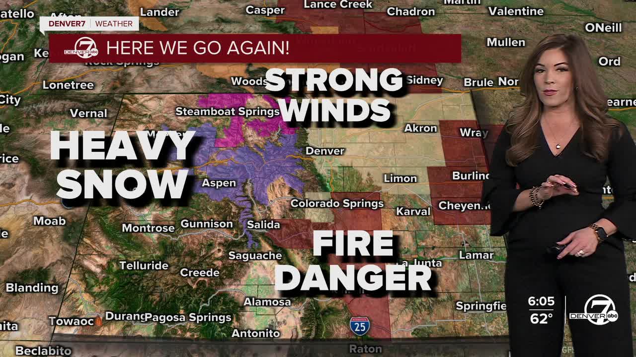


DENVER — After a day of fierce winds across the Front Range foothills and Denver metro, high fire danger remains a big concern heading into Thursday. Gusty winds, warm temperatures and dry conditions return as a Fire Weather Watch will be in place across much of E. Colorado.
Tonight, look for a few light showers across the northeastern plains as a weak cold front drops into the state. Otherwise, we'll sit under partly cloudy skies with overnight lows in the mid-30s.
Snow winds down in the mountains overnight but the winds remain the top story again on Thursday. We'll see wind gusts up to 40mph around the Denver metro area and plains with low humidity values as a Fire Weather Watch is in effect from 11am to 5pm.
It'll be sunny but a bit dusty from the strong winds Thursday. Daytime highs will warm into the low 60s along the I-25 corridor. Breezy conditions continue Friday but fire danger concerns will lessen a bit.
Temperatures skyrocket back into the upper 60s as we wind down the month of February Saturday. So far, it looks like a mild start to March with a few isolated showers Sunday evening.
A more active weather pattern is possible next week.
DENVER WEATHER LINKS: Hourly forecast | Radars | Traffic | Weather Page | 24/7 Weather Stream
Click here to watch the Denver7 live weather stream.
