


Temperatures stayed in the upper 90s in Denver, just shy of the record high of 100 degrees, last set back in 1962.
Look for the lingering storms to move out tonight with gradual clearing skies by Friday morning. Overnight lows will dip into the upper 50s to low 60s.
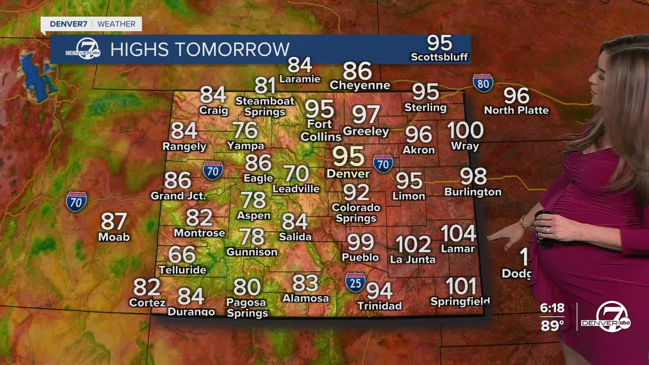
The heat won't let up. We're back to the mid-90s again Friday afternoon along the Interstate 25 corridor. Mostly sunny skies kick off the day with increasing afternoon clouds along with a few dry thunderstorms. These are storms that bring little rain but a lot of lightning and gusty winds. It's unfortunately perfect conditions for new wildfire starts.
We'll see a better chance of storms on Saturday, with some higher humidity in the mountains and across the western slope. Temperatures will stay a few degrees above average, but it won't be quite as hot as what we've dealt with this week.
Look for low 90s Saturday and Sunday with gradually warming temperatures each day next week. The hot and dry weather pattern is back as head into the middle of August.
DENVER WEATHER LINKS: Hourly forecast | Radars | Traffic | Weather Page | 24/7 Weather Stream
Click here to watch the Denver7 live weather stream.
