


DENVER — It's been a hot start to August and that trend will continue for a few more days! Temperatures will soar into near record-setting territory through Friday.
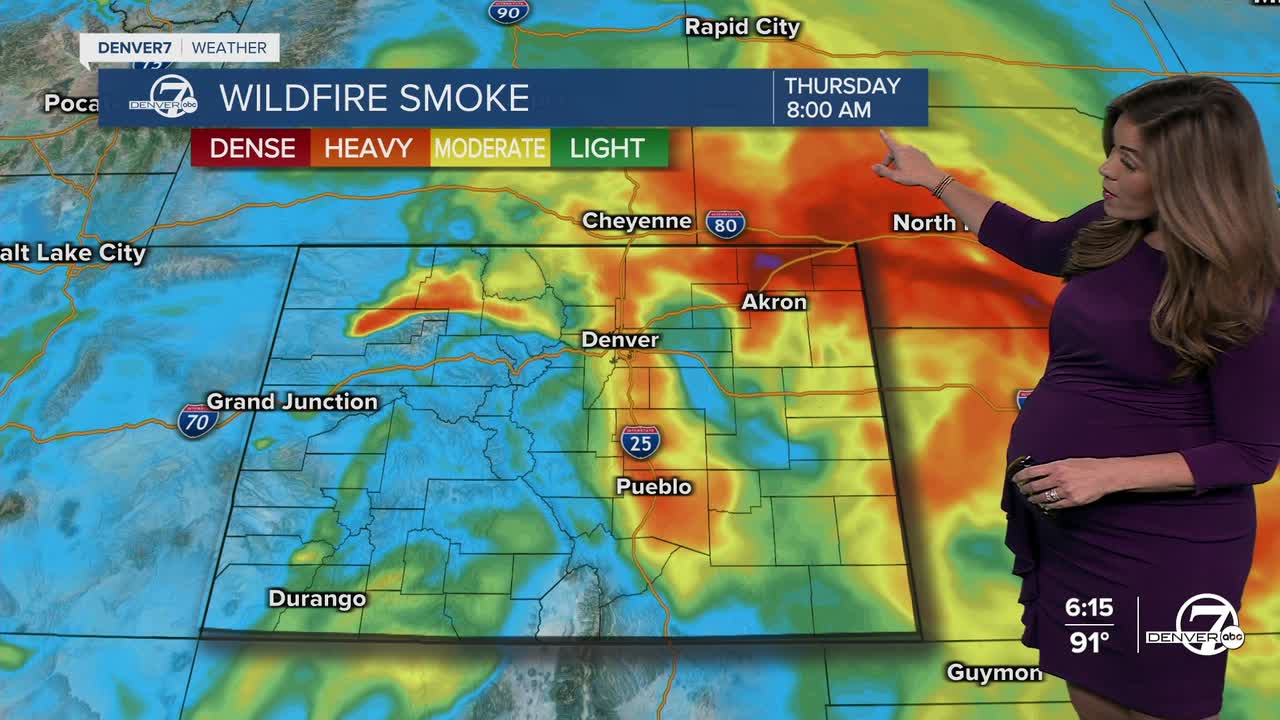
Besides the heat, the Front Range is still dealing with thick, dense smoke from wildfires burning out west, so expect some hazy skies off and on over the next few days. An Air Quality Health Advisory is in effect for much of northwestern Colorado and the Denver metro area through Thursday afternoon for high levels of smoke particulates and ozone.
A ridge of high pressure will remain in place through the end of the week and that will usher in some hot, dry air from the desert southwest. We'll see upper 90s to even some the low 100s through Friday.
A Heat Advisory is in effect for much of the Denver metro area and Interstate 25 corridor from 10 a.m. to 7 p.m. Thursday. Daytime highs are expected to skyrocket into the low 100s across much of the plains. Check in on your friends, family and neighbors and make sure they're staying cool.
The record high in Denver for Thursday is 99 degrees, last set in 1980. The current forecast high is 100 degrees in the city, so we'll likely tie and maybe even break that record.
By late in the week, moisture slowly starts to return as a weather system approaches from the northwest. A backdoor cold front will scoot across eastern Colorado late Friday, dropping daytime highs into the 80s for the weekend. We'll be tracking a better chance of some much-needed showers and storms Saturday and Sunday afternoons.
DENVER WEATHER LINKS: Hourly forecast | Radars | Traffic | Weather Page | 24/7 Weather Stream
Click here to watch the Denver7 live weather stream.
