


DENVER — After a couple of strong storms formed along the Palmer Divide this afternoon, the skies have quieted down this evening. There's still a chance for a spotty shower or storm late Tuesday as overnight lows drop into the 60s and 50s for the Front Range.
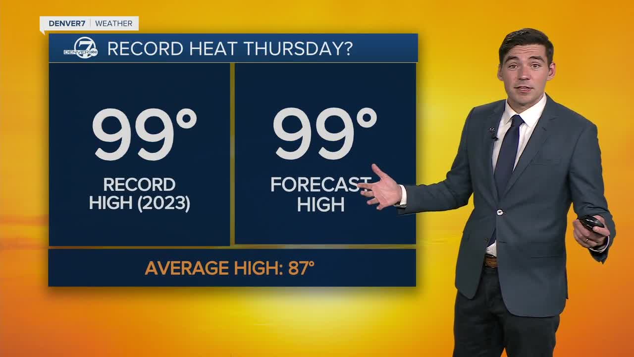
Wednesday is shaping up to be an even hotter day, and Thursday could bring record heat to Denver. The daily record set in 2023 is 99 degrees, and Thursday could match or even beat that mark. Storm chances the next couple of days will be minimal.
Starting Friday, a cold front rolls in and brings a huge drop in temperatures and much better chances for rain. Highs will fall to only the 80s Friday and Saturday, while we could be looking at highs in the 70s on Sunday.
DENVER WEATHER LINKS: Hourly forecast | Radars | Traffic | Weather Page | 24/7 Weather Stream
Click here to watch the Denver7 live weather stream.
