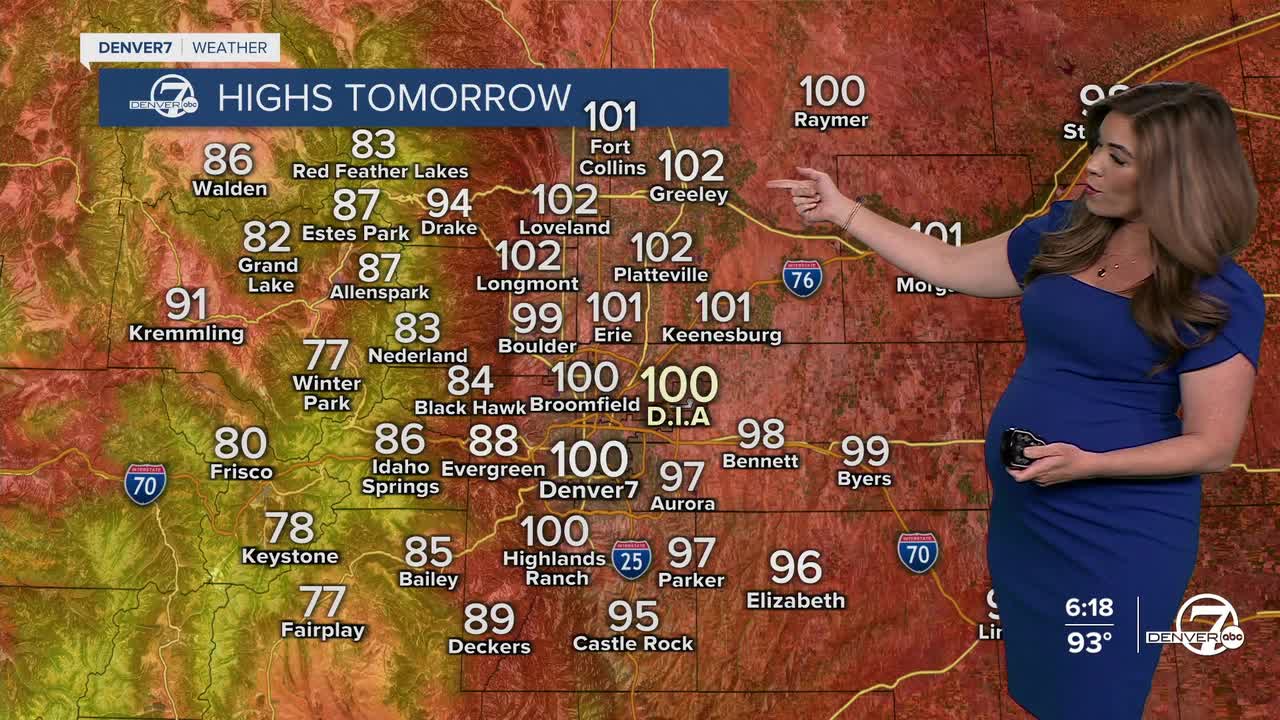


DENVER — The summer sizzle is officially on! Denver could see its first 100+ degree day of the year Wednesday.
A Heat Advisory will go into effect for the Denver metro area from 10 a.m. to 9 p.m. Wednesday for the extreme heat. Check in on your neighbors and friends to make sure they're staying cool.
We're tracking a ridge of high pressure swinging into Colorado mid-week, ushering in the record-breaking heat and sunshine. Temperatures will be in the mid 90s around the lunch hour with triple-digits along the I-25 corridor late Wednesday afternoon with some increasing clouds.
Wednesday's record high in Denver is 100 degrees last set in 2022, so there's a good chance that we could tie or even break it!
It'll still be warm with partly cloudy skies and very isolated storms Thursday. Look for highs in the low to mid 90s around the Denver metro and plains.
A weak cold front moves through Thursday night and that will bring us a solid 15 degree cool down on Friday. It will feel like a dream! We'll see highs in the low to mid 80s, with scattered afternoon storms to round out the week.
A few storms will linger into the start of the weekend, with warmer and drier weather on tap early next week.
DENVER WEATHER LINKS: Hourly forecast | Radars | Traffic | Weather Page | 24/7 Weather Stream
Click here to watch the Denver7 live weather stream.
