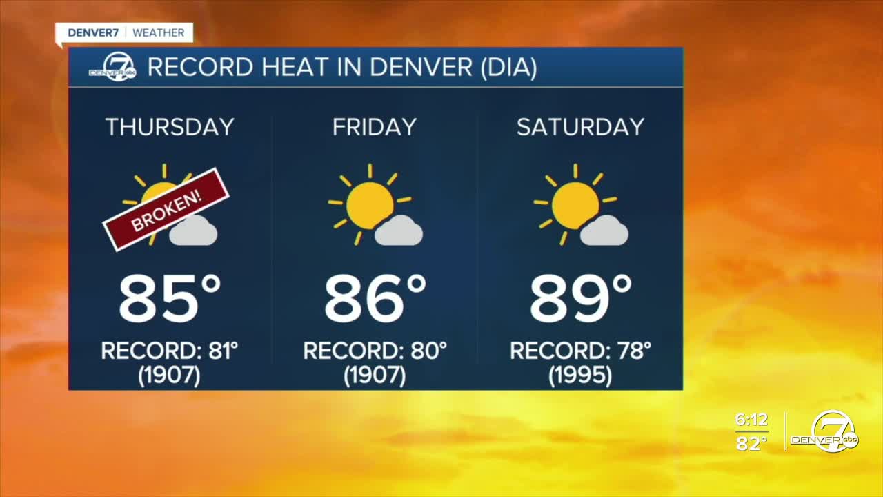


DENVER — Here comes the heat, Colorado! Denver shattered the all-time hottest March temperature Thursday with a high of 85-degrees. The previous record was 84-degrees, last set on March 26, 1971. The city broke the daily record as well, crushing the previous one of 81-degrees, last set in 1907.

Tonight, look for mostly clear skies across the state with very mild temperatures statewide. Open up the windows and let in the cool, fresh air! We'll drop into the mid to upper 40s along the Urban Corridor by Friday morning.
Temperatures skyrocket back into the mid to upper 80s again on Friday, the first day of spring. The current record high is 80-degrees, set in 1907 which will easily be broken. Look for plenty of sunshine and dry conditions across the state.
The winds won’t be quite as strong, but humidity levels will be extremely low, which keeps fire danger elevated. A Red Flag Warning is in effect again on Friday from late morning through early evening for northern Colorado, meaning conditions are favorable for rapid fire spread.

Saturday will be the hottest and most concerning day, as highs soar to near 90-degrees and winds pick up quite a bit. Humidity levels will drop into the single digits in some areas, so it'll be a bone dry day. With that combination, we will likely see widespread critical fire weather conditions, making any outdoor burning or sparks especially dangerous.
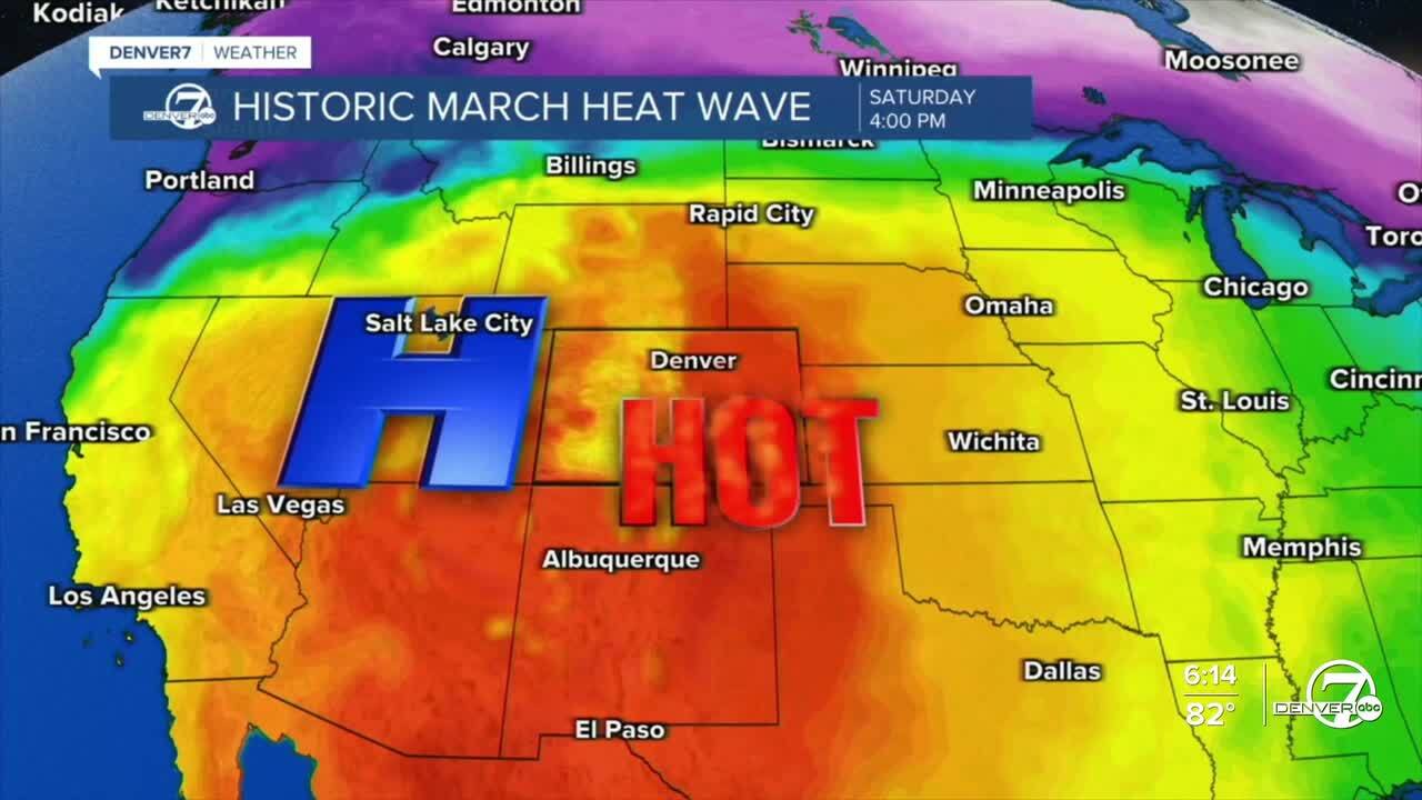
A weak cold front moves through late Saturday into Sunday, bringing a brief cool down. Temperatures will drop back closer to normal, mainly into the 60s, and there could be a few light showers, especially in the mountains. It’s not a big storm, but it will at least provide a short break from the extreme heat and fire danger.
That break doesn’t last long. By early next week, warm and dry weather builds back in, with temperatures climbing into the low-80s Tuesday and mid-80s Wednesday. We'll likely break the daily high records on both of those days.
Along with the heat, gusty winds may return, bringing another round of elevated to critical fire weather concerns as we head into the middle of the week.
DENVER WEATHER LINKS: Hourly forecast | Radars | Traffic | Weather Page | 24/7 Weather Stream
Click here to watch the Denver7 live weather stream.
