


DENVER — Here comes the next cold front, Colorado! And it'll usher in blustery winds and chilly temperatures overnight.
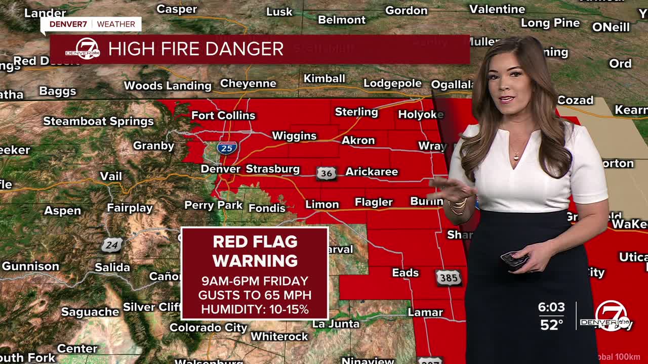
Strong winds will whip across the Front Range foothills, Denver metro and Eastern Plains throughout the day on Friday prompting high fire danger yet again. A Red Flag Warning will go back into effect for much of northeastern Colorado Friday morning through the evening, with wind gusts near 75 mph. A High Wind Warning is in effect until 5pm Friday for parts NE Colorado as winds continue to ramp up as the cold front surges into the state.
Along with the strong winds, look for much cooler temperatures in the low 40s Friday under a partly cloudy sky.
So far, it looks like the cooler air will stay in place for the start of the weekend. Broncos fans, dress in layers if you're tailgating out at Empower Field on Saturday morning. Highs will be in the upper 30s to low 40s with breezy winds and mostly sunny skies.
Temperatures jump back into the mid 50s Sunday before another brief cool off on Martin Luther King Jr. Day.
DENVER WEATHER LINKS: Hourly forecast | Radars | Traffic | Weather Page | 24/7 Weather Stream
Click here to watch the Denver7 live weather stream.