


DENVER — It's a quiet and fairly calm start to the week but that's about to change. We're expecting some gusty winds on the plains and some heavy snow in the mountains.

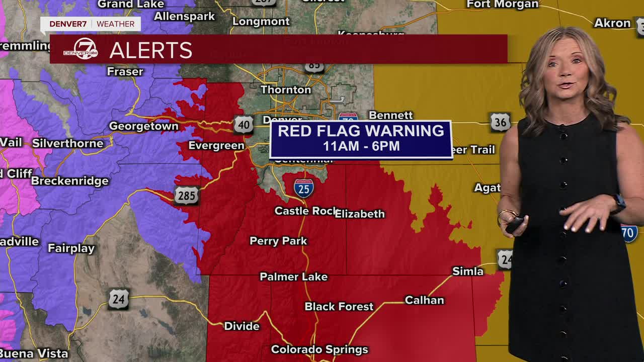
The winds will pick up throughout the day, with gusts near 60 mph along the Front Range. We'll see some of the gustiest winds in the foothills and south along the Palmer Divide. That combined with temperatures near 70 degrees has prompted a Red Flag Warning in effect from 11 a.m. to 6 p.m. on Monday. The record high on Monday is 75 degrees and we're calling for highs in the upper 60s to low 70s across the plains.
The mountains could see some light snow, but heavier snow is in store on Tuesday. In fact, Tuesday is the big day to watch. A strong storm system moving in from the West Coast will crank up the wind dramatically across the foothills and all of the Eastern Plains. We’re talking very strong gusts that could exceed 50 mph in some spots, possibly even stronger in the mountains. It will stay very dry on the plains, so extreme fire danger is possible. This could be one of those days where any spark becomes dangerous fast.
A number of winter weather alerts go into effect across the Colorado high country from early Tuesday to early Thursday. The high mountain passes west of the Divide could see 1 to 2 feet of snow. We'll see around 4 to 10 inches of snow across the northern Front Range mountains and foothills. Again, these are 48-hour snowfall totals from early Tuesday to early Thursday.
After Tuesday, we don’t completely calm down. Wednesday will be a little cooler, but still windy and dry enough for continued fire concerns on the plains. The mountains may get another round of snow midweek, possibly with better accumulation as colder air moves in. Through the rest of the work week, expect ongoing fire weather concerns on the plains and periodic snow and wind in the mountains, an active and potentially hazardous stretch of February weather across Colorado.
DENVER WEATHER LINKS: Hourly forecast | Radars | Traffic | Weather Page | 24/7 Weather Stream
Click here to watch the Denver7 live weather stream.
