


DENVER — It'll still be a blustery night across the Front Range foothills, Denver metro and eastern plains. Look for mostly cloudy skies overnight with lows in the teens on the plains. A bit of light snow is possible in the northern mountains overnight.
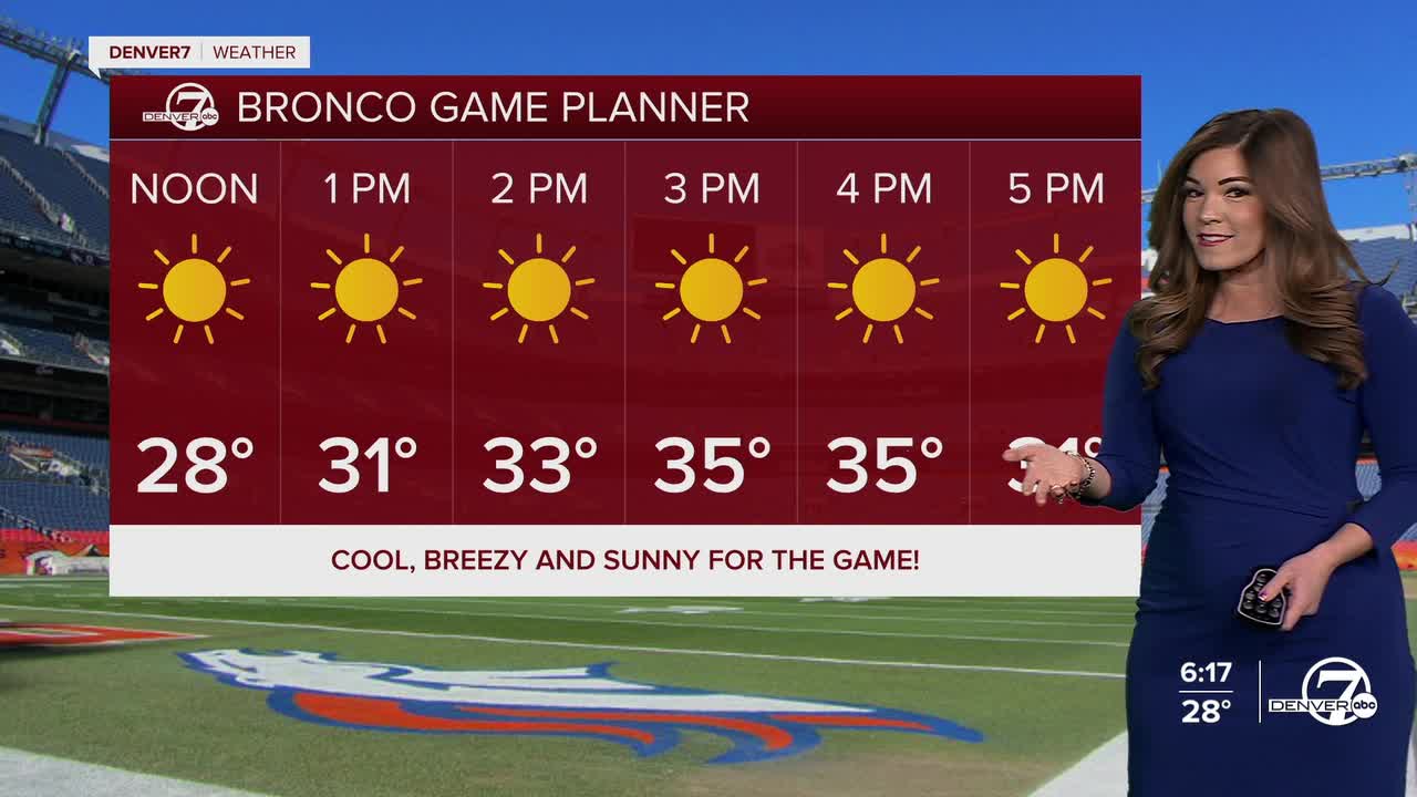
We'll have a sunny start to your Saturday in the Denver metro but temperatures remain below-average! Broncos fans, dress in layers if you're tailgating out at Empower Field on Saturday morning. Highs will stay in the mid to upper 30s Saturday afternoon. While the winds won't be quite as strong in the city, they will continue to howl east of I-25.
The strong winds and dry conditions will lead to high fire danger yet again on Saturday for northeastern Colorado. A Red Flag Warning is in effect for Morgan, eastern Adams and Arapahoe, northeast Elbert, Lincoln, Logan, Washington, Sedgwick and Phillips counties from 8am to 5pm Saturday, with wind gusts near 55 mph.
Temperatures jump back into the mid 50s Sunday under a mostly sunny sky in Denver before another brief cool off on Martin Luther King Jr. Day. Some computer weather models bring in a bit of light snowfall early Monday morning to the Front Range. So far, it looks like only an inch in the city. Stay tuned as we fine tune totals as the storm gets closer!
DENVER WEATHER LINKS: Hourly forecast | Radars | Traffic | Weather Page | 24/7 Weather Stream
Click here to watch the Denver7 live weather stream.
