


DENVER — Strong winds will continue Tuesday night, particularly near the base of the foothills from Golden to Lyons.
Wind gusts up to 55 mph, while locations farther east across the plains remain breezy but less intense.
Wednesday will remain dry, with lighter winds compared to Tuesday.
Afternoon high temperatures are expected to reach the upper 50s across the I-25 urban corridor.
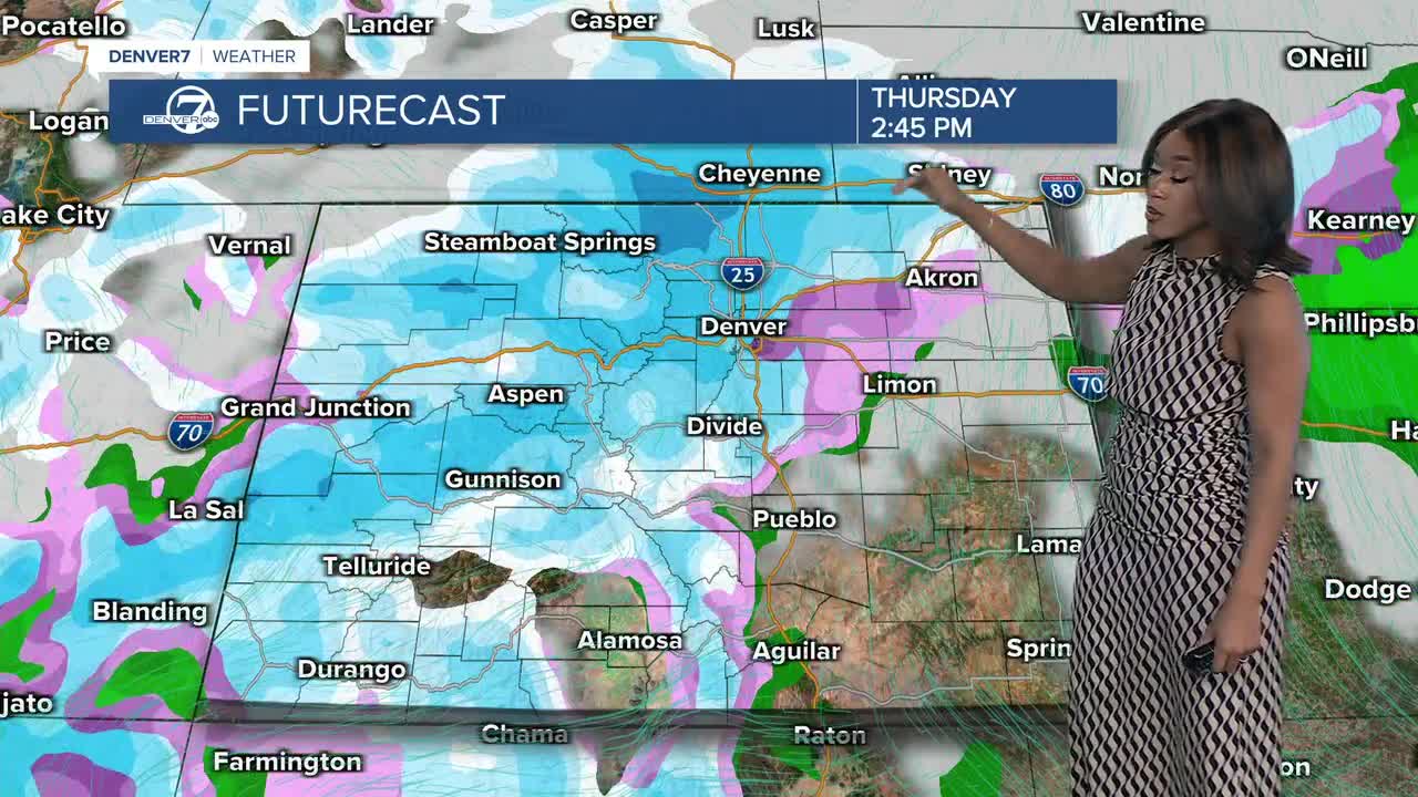
A new storm system is expected to move into the region on Thursday, bringing colder air and moisture to Colorado.
Snow is expected to develop by Thursday afternoon or evening along the I-25 urban corridor.
The mountains are expected to receive the most snowfall, up to 9 inches, on the higher peaks.

Snow may linger into early Friday morning before moving eastward and tapering off.
This system is not expected to produce significant snowfall, and slick roads are possible during the Friday morning commute, especially where snow continues overnight.
Temperatures will remain cold through the end of the week before drier conditions return Saturday.

DENVER WEATHER LINKS: Hourly forecast | Radars | Traffic | Weather Page | 24/7 Weather Stream
Click here to watch the Denver7 live weather stream.
