


DENVER — Monday shaped up to be the coldest day of the week across much of the Front Range.
Cold is expected to linger on Monday night, with temperatures expected to dip into the 20s for lower elevations.
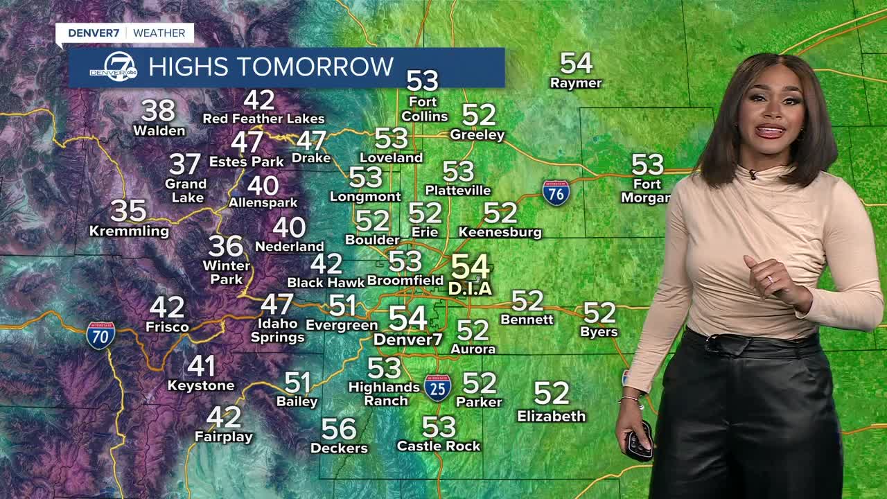
Things start to turn slightly warmer on Tuesday.
Warmer air moves in as high pressure builds over Colorado.
Highs will rebound into the low to mid 50s across the region.
Just in time for celebrations, the New Year’s Eve celebration will have highs in the upper 50s.
Fireworks forecasts will have nighttime lows dipping into the 30s with dry conditions.

Expect dry and mostly sunny skies, and temperatures to continue running well above normal for late December, as we head into January.

DENVER WEATHER LINKS: Hourly forecast | Radars | Traffic | Weather Page | 24/7 Weather Stream
Click here to watch the Denver7 live weather stream.
