


DENVER — Starting tonight, expect a few showers moving through as a weather system approaches, especially in the mountains where light snow could fall above 9,500 feet. For most lower elevation areas, rain chances will be on the lower side and mainly limited to spots south of I-76. Any storms this evening should be fast-moving, and while most won't be severe, there's still a small chance a stronger storm could produce higher wind gusts, especially in Lincoln and Washington Counties. Temperatures will cool off by Thursday morning behind a passing cold front.

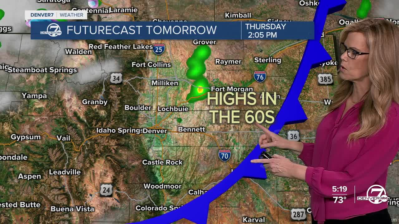
Thursday will feel noticeably cooler, highs will drop by 15–20 degrees compared to today. Most of the showers should taper off by mid-morning or early afternoon, though a few could linger near the far northeast corner of the state. As skies clear and drier air settles in Thursday night, patchy frost is expected to develop on the plains—mainly in spots like the South Platte River Valley and Lincoln County. If you're in a rural or low-lying area, it’s a good night to bring sensitive plants indoors or cover them up.

Friday will be calm and seasonable, with highs in the 60s across the plains and 40s to 50s in the mountains. It’ll be a good day to get outside before colder weather returns again. Saturday will bring another cool-down as a weak trough slides by to our northeast. Expect breezy conditions through much of the day, and overnight temperatures will dip even further—likely below freezing across much of the plains. If you haven't already, it's probably time to start thinking about shutting down sprinklers and prepping for frost season.

Sunday looks like a short break from the cooler pattern. Temperatures will rebound by about 10 degrees, skies will be dry, and overall it should be a pretty pleasant fall day. But don’t get too comfortable, the next storm system is already on the horizon. By Monday, another trough will begin to move into the region, and that could bring our next round of more widespread precipitation. There’s still a lot of uncertainty in the exact track of this system, but colder air looks likely, meaning snow for the mountains and maybe even a wintry mix at lower elevations Monday night into Tuesday if the coldest scenarios play out.
There’s still time for the details to shift, but it’s something to keep an eye on if you have travel plans or outdoor work early next week. Also worth noting: if drier air holds on in our southern plains Monday, increasing winds could lead to elevated fire weather conditions there. So, to sum it up, short-term cool and breezy with a couple frosty mornings, a brief warm-up Sunday, then potentially a colder, wetter start to next week.
DENVER WEATHER LINKS: Hourly forecast | Radars | Traffic | Weather Page | 24/7 Weather Stream
Click here to watch the Denver7 live weather stream.
