


DENVER — Who's enjoying the cooler temperatures?! We're in for a couple more days of below-average daytime highs around the Denver metro area before another warm up arrives this weekend and into next week.
As the storms move out, partly cloudy skies move in overnight as temperatures dip into the mid to upper 50s along the Interstate 25 corridor.
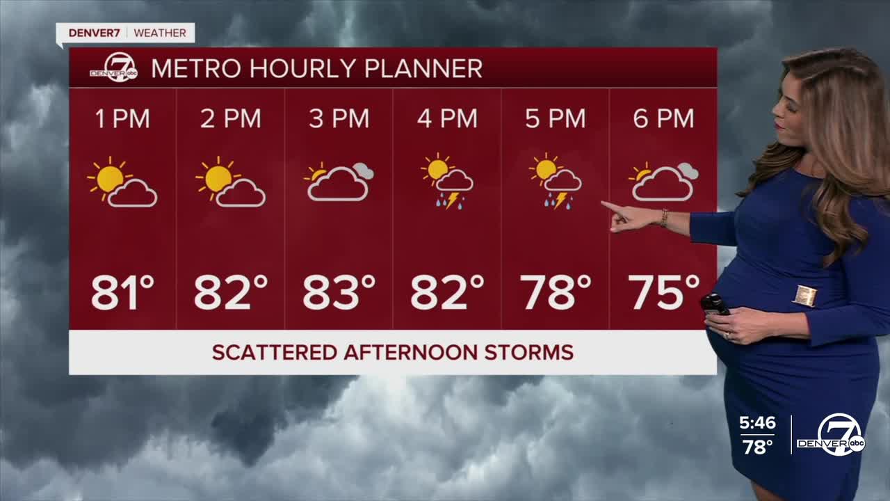
Look for plenty of sunshine to kick off your Thursday with increasing clouds by the early afternoon. Another round of storms with possibly heavy rainfall is expected Thursday between 3pm and 7pm across the Denver metro area. Some storms could linger late into the night along the plains.
Much of the Interstate 25 corridor is under a marginal risk of severe storms Thursday. Flash flooding, brief but heavy rains, large hail and damaging wind gusts will all be the biggest threats.
Daytime highs will again be a bit cooler, in the low to mid 80s Thursday and Friday. Scattered afternoon and evening storms will pop up again on Friday with more isolated storms possible Saturday.
Looking ahead to the weekend, conditions are expected to dry out and warm up. With the ridge shifting directly overhead, highs will climb back into the 90s for the plains and Denver metro area, with fewer storms for the northeastern plains.
The dog days of summer hold on for the first full week of August!
DENVER WEATHER LINKS: Hourly forecast | Radars | Traffic | Weather Page | 24/7 Weather Stream
Click here to watch the Denver7 live weather stream.
