


DENVER — Our warm and dry pattern will carry into Christmas Eve and Christmas Day, with Denver's highs expected to reach the upper-60s or low 70s as high pressure remains anchored over Colorado and the Mountain West.
We are forecasting highs very close to the all-time Denver records for Dec. 24 (70 degrees) and Dec. 25 (69 degrees)
The high country will also stay much warmer than average, with breezy to occasionally gusty winds expected to peak on Friday.
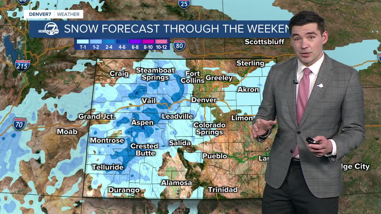
Our next system moves in on Christmas Day, bringing scattered rain and snow showers to the high country. Snow chances will follow Friday and Saturday in the mountains as cold air moves in, though snowfall totals are looking relatively modest at this point.
The metro area will see only a slight chance for some spotty showers this weekend, but a big cooldown is on the way. Metro highs will fall back into the 50s on Saturday and back to the low-40s on Sunday, which is right around average for this time of year.
DENVER WEATHER LINKS: Hourly forecast | Radars | Traffic | Weather Page | 24/7 Weather Stream
Click here to watch the Denver7 live weather stream.
