


DENVER – After a busy afternoon of severe storms in the southern metro area, conditions are gradually calming this evening.
A few severe storms are possible along the far Eastern Plains as the National Weather Service (NWS) in Boulder continues the severe thunderstorm watch until 8 p.m.
Counties in the watch area include:
- Lincoln
- Phillips
- Sedgewick
- Washington
As the storms push out of the state after midnight, mostly cloudy skies will be left in their wake. Look for overnight lows in the upper 50s to low 60s across much of Eastern Colorado.
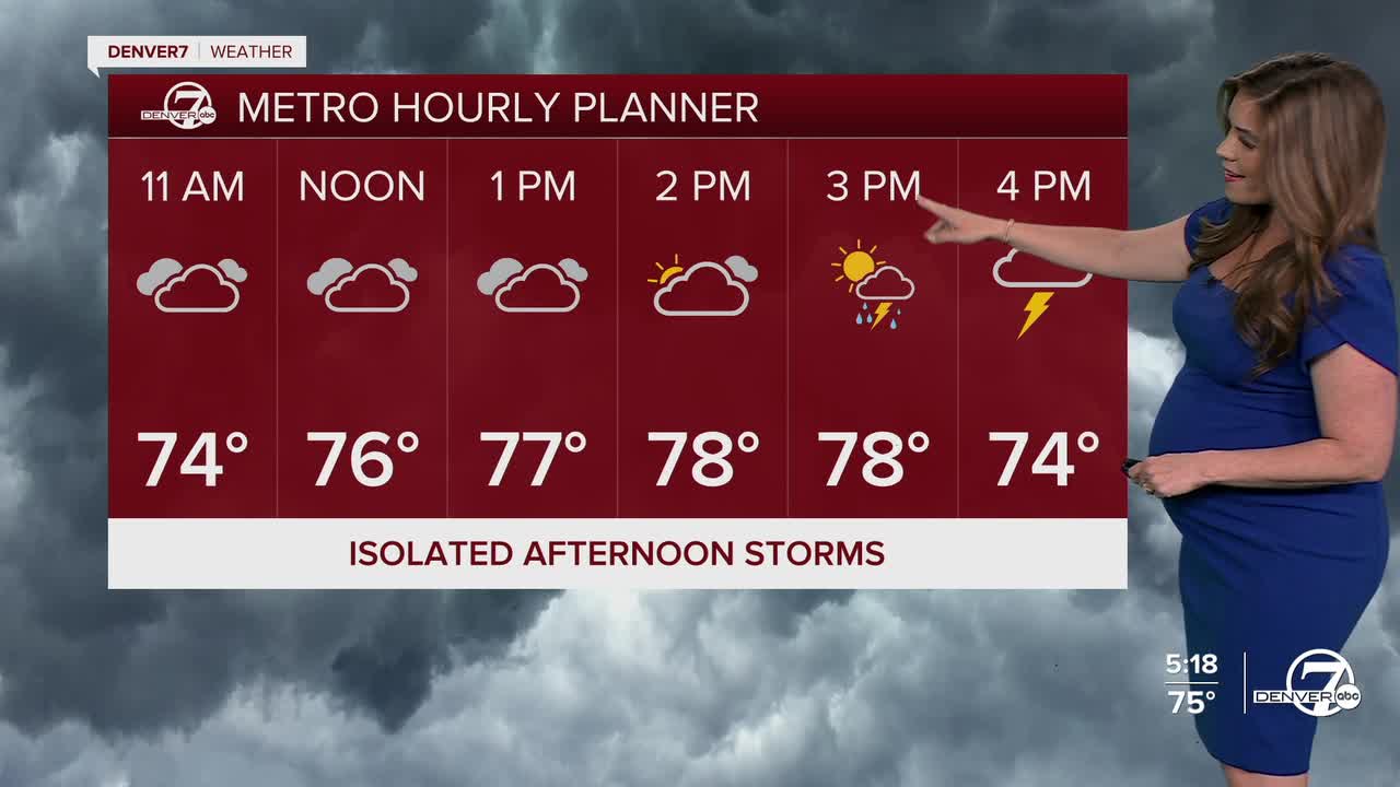
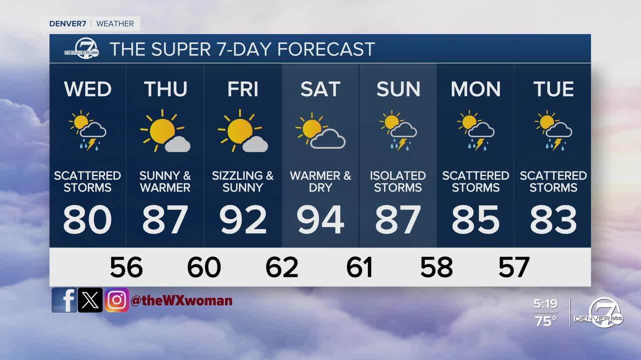
It'll be a mostly cloudy start to your Wednesday along the I-25 corridor with a few scattered afternoon storms. So far, it looks like far northeastern Colorado could see a couple turn severe in the early evening. Large hail and damaging wind gusts up to 60+ mph will be the biggest threats again. We'll have a low risk of severe weather in the Denver metro.
Look for below-average temperatures in the upper 70s to low 80s Wednesday afternoon. Enjoy the 'cooler' temperatures while they're here!
A ridge of high pressure moves back into Colorado to wind down the work week, ushering in sunny skies and warmer temperatures. High temps will soar into the upper 80s to low 90s Thursday through Saturday.
Look for a few isolated storms Sunday afternoon with more widespread storms early next week. Temperatures will also return to more seasonal norms.
DENVER WEATHER LINKS: Hourly forecast | Radars | Traffic | Weather Page | 24/7 Weather Stream
Click here to watch the Denver7 live weather stream.