


DENVER — Buckle up, Colorado! It'll be a one-two punch as arctic air seeps into eastern Colorado and heavy snow slams the mountains starting Friday.
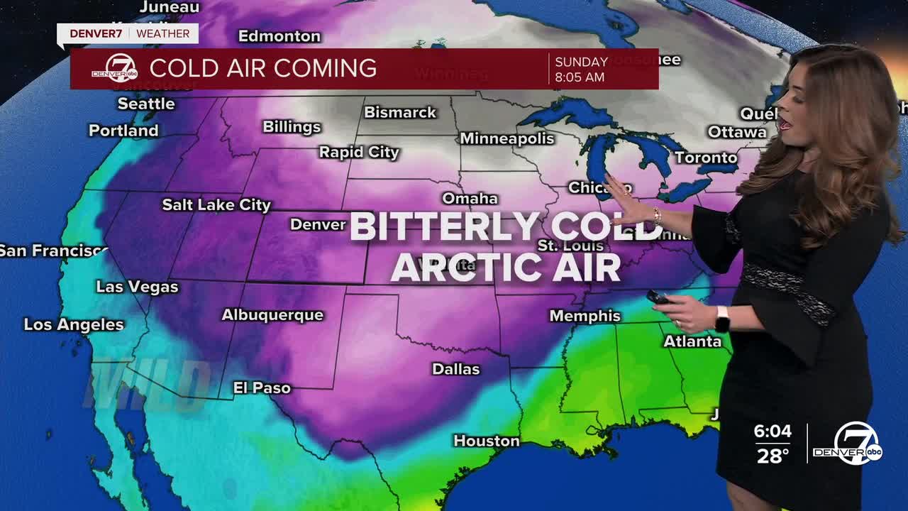
A bitterly cold airmass slides into eastern Colorado, and temperatures take a big dive heading into the weekend. We’re talking highs stuck in the teens and low 20s, and once you factor in the wind, it’s going to feel flat-out cold. Wind chills will drop below zero on the plains, so this is when the heavy coats, hats and gloves become non-negotiable. A Cold Weather Advisory is in effect from early Friday morning until Sunday for wind chills of 20 degrees below zero for the Eastern Plains.
Along with the cold, a major winter storm moves into Colorado starting early Friday morning. It hits the San Juans first then spreads northward. If you're traveling along I-70 Friday, Mother Nature will slow you down. Winter Weather Advisories go into effect early Friday for the central and southern mountains. The San Juans will see 6 to 12 inches, with 4 to 10 inches possible around I-70 and Summit County through Saturday night.
Light snow showers arrive to the Denver metro area and Eastern Plains Friday night. This isn’t a big snowstorm for the city, but enough flakes could fall to put a thin layer on roads and sidewalks. With how cold it’ll be, even light snow could make travel pretty slick. Most of the snow showers move out of Denver midday Saturday. So far, we're expecting a trace to 3 inches of new snow around the Mile High City.
Saturday is likely the coldest day of the whole stretch. Highs may only make it into the low to mid teens, and Saturday night could be brutally cold if skies clear out. Some spots could drop well below zero, and the wind will make it feel even worse. It's definitely a good time to stay inside if you can and keep an eye on pets and pipes.
By Sunday, things start to improve a bit. Temperatures warm slightly but we’re still below freezing. It looks like highs will stay in the low 20s for the Broncos game.
Early next week looks calmer and warmer, with sunshine and highs climbing back toward more seasonal averages.
DENVER WEATHER LINKS: Hourly forecast | Radars | Traffic | Weather Page | 24/7 Weather Stream
Click here to watch the Denver7 live weather stream.
