


DENVER — Buckle up, Colorado! We're in for two more days of fierce winds and high fire danger.
While the winds weaken a bit along the Urban Corridor this evening, it'll be a blustery night in the Front Range mountains and foothills. Wind gusts will continue to howl up to 75 mph. Temperatures will dip into the upper 30s to low 40s overnight around the Denver metro under partly cloudy skies. A weak cold front will move into the northeast plains overnight, bringing much cooler temperatures as some areas will drop below freezing.
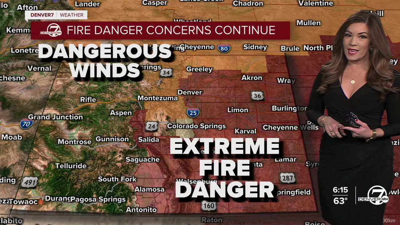
A High Wind Warning is in effect through noon Friday for the Front Range mountains, foothills and parts of northern Colorado for continued windy conditions. Meanwhile, a Red Flag Warning for high fire danger goes back into effect at 11am until 8pm Friday for the Interstate 25 corridor, Denver metro and Eastern Plains. The winds won't be quite as strong as Thursday, but still will gust between 30 to 50 mph. Because the air remains very dry, any fire that starts could spread quickly.
Temperatures will warm into the low 70s in Denver Friday under partly sunny skies.
Saturday will bring another warm and windy day, with temperatures climbing into the mid 70s yet again. A Fire Weather Watch is in effect for the Denver area and plains as winds will gust between 40 and 60 mph, again creating critical fire weather conditions. Later Saturday evening, a cold front will move in, bringing stronger northerly winds and a sharp drop in temperatures.
Behind the cold front, snow is expected to develop in the mountains Saturday night and could spread into some lower elevations through early Sunday. The mountains may receive several inches of snow, while parts of the plains could see light accumulations if narrow snow bands develop. After this brief return to winter, temperatures will warm quickly starting Monday and could reach record-breaking levels by the middle of next week. It'll be a week of weather whiplash.
DENVER WEATHER LINKS: Hourly forecast | Radars | Traffic | Weather Page | 24/7 Weather Stream
Click here to watch the Denver7 live weather stream.
