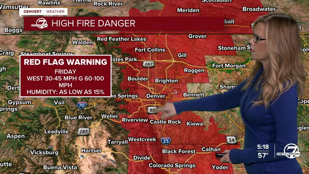


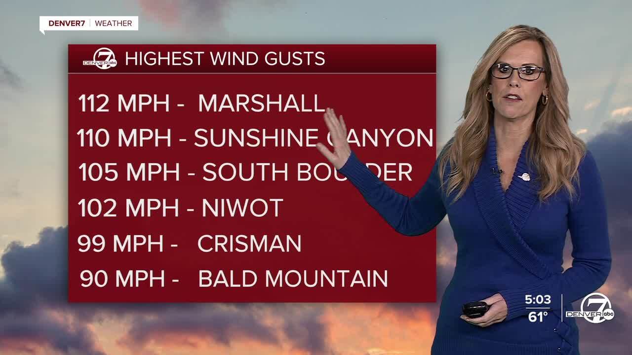
DENVER — Tonight, very strong winds and very dry air will continue across the foothills, nearby plains, and along the I-25 corridor, keeping fire danger high, especially in Larimer, Boulder, and Jefferson Counties and along Highway 93. Winds are not as strong as earlier, but gusts of 35 to 50 mph are still possible into the evening and overnight. Conditions will slowly improve after sunset as winds weaken and humidity begins to recover, with a weak cold front bringing some relief late tonight.
Overnight into Saturday morning, winds will remain breezy at times, particularly near the foothills and across the plains, but overall conditions will continue to trend better. Fire weather concerns will slowly ease as cooler air moves in and moisture increases slightly. Skies will stay mostly clear outside of the mountains, and no major weather impacts are expected on the plains during the day Saturday aside from lingering wind.

In the mountains, snow will develop late tonight and continue through Saturday. Snowfall will generally be light to moderate, but gusty winds may create areas of blowing snow. Travel conditions are expected to deteriorate, especially along and north of I-70, where slick and snow-covered roads are likely at times. A Winter Weather Advisory is in effect from midnight tonight through midnight Sunday.
Snow showers in the mountains may linger into Saturday night and Sunday, but overall snowfall totals are not expected to be excessive. Even so, the combination of wind and snow could still make mountain travel slow and difficult at times. Conditions should gradually improve later Sunday as snowfall tapers off.
Looking ahead to next week, a warmer and drier weather pattern is expected to return. Temperatures will climb well above normal, with many areas seeing highs in the 60s and even 70s. Most of the region will stay dry, though there are early signs that a more wintry pattern could return to the mountains later in the week. Details on that are uncertain, but it will be something to watch.
Relative humidity could drop as low as 12%, meaning there will not be a lot of moisture in
WEATHER LINKS: Hourly forecast | Radars | Traffic | Weather Page | 24/7 Weather Stream
Click here to watch the Denver7 live weather stream.
