


DENVER — If it feels more like spring than winter. You’re not imagining it.
Monday brings critical fire weather conditions to parts of Colorado, especially near the foothills, the Palmer Divide and South Park.
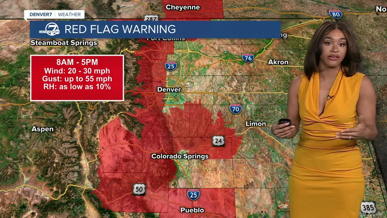
The National Weather Service in Denver has issued a Red Flag Warning from 8 a.m. to 5 p.m. due to strong winds and extremely low humidity.
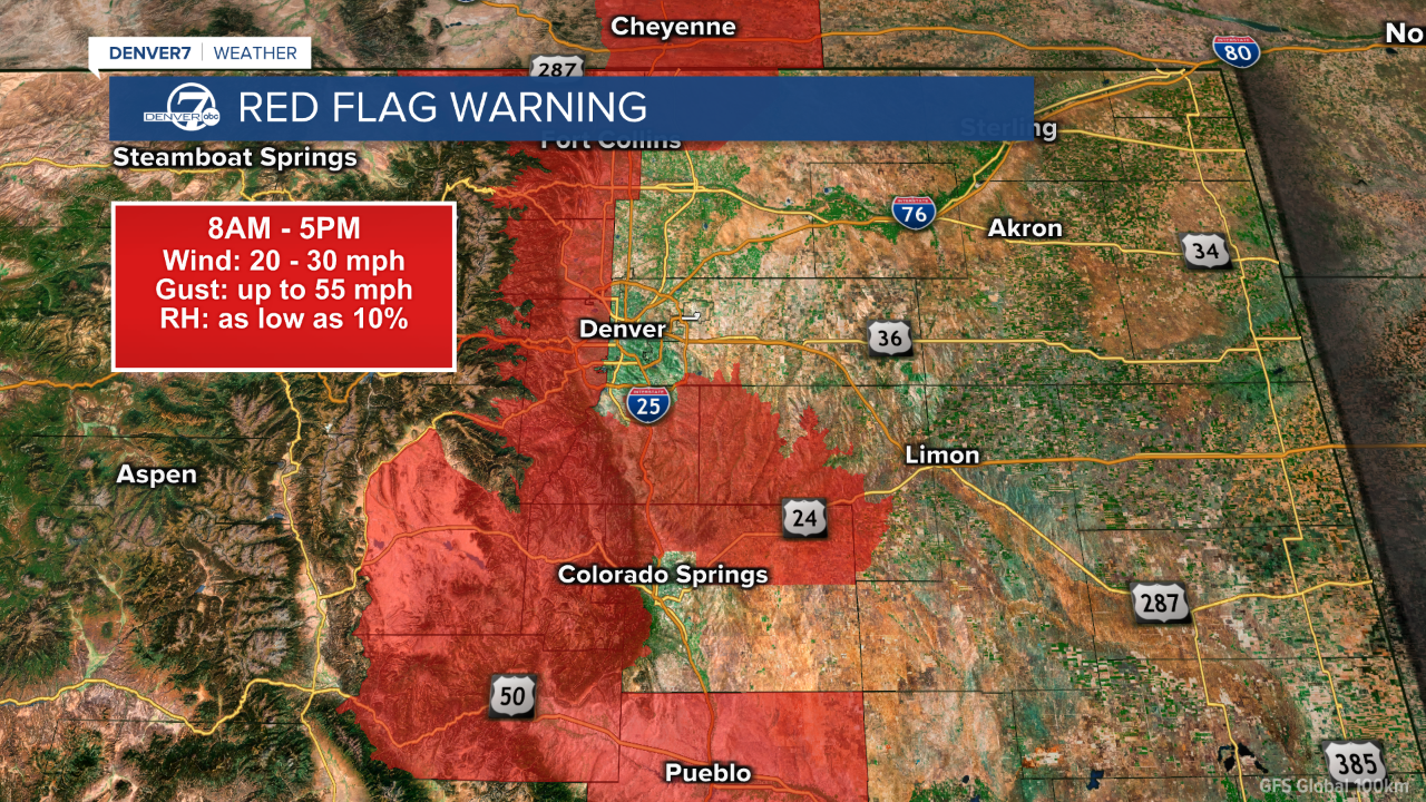
Winds will gust up to between 35 to 55 mph, and relative humidity could drop as low as 10%, creating dangerous conditions for rapid fire spread.
At the same time, we’re tracking near-record warmth.
High temperatures across the Interstate 25 corridor and Eastern Plains will climb into the upper 60s to low 70s.
The fire danger eases slightly on Tuesday as winds relax, but the warm and dry pattern continues.
Temperatures will remain well above normal, with highs again reaching the 60s and low 70s in many spots.
This mild pattern sticks around through Christmas Day.

If you’re hoping for a white Christmas, the best chance for wintry weather is to stay in the mountains.
DENVER WEATHER LINKS: Hourly forecast | Radars | Traffic | Weather Page | 24/7 Weather Stream
Click here to watch the Denver7 live weather stream.