


DENVER — The storms are gradually moving out of the state tonight, leaving mostly cloudy skies in their wake. Temperatures will drop into the low 60s across the Denver metro area and plains overnight.
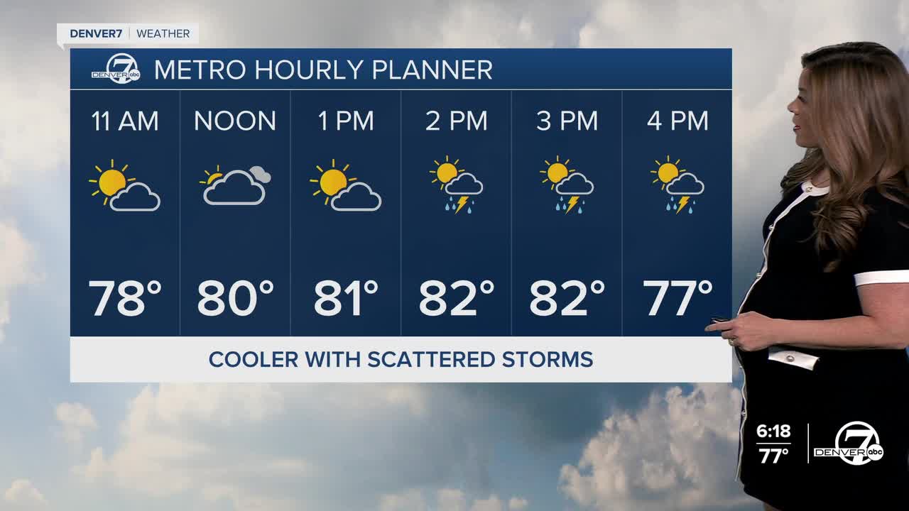
We're in for a mix of sun and clouds to kick off your Thursday. Daytime highs stay below-average, in the low to mid 80s along the I-25 corridor. Look for another round of slow-moving, scattered storms and heavy rain Thursday afternoon and early evening across the Front Range and eastern plains. The storms will fire up around 2-3pm and continue through the dinner hour. Flash flooding will once again be the biggest concern.
This heavier rain is due to a monsoon flow that is making a comeback to much of the state. This bump in tropical moisture could lead to some localized flooding, particularly in mountain areas and spots that have already seen recent rain.
The relief doesn't last long as 90-degree heat returns on Friday. Daytime highs soar into the low to mid 90s on Friday and Saturday and many lower elevation spots could be flirting with triple digits on Sunday. Denver's current record on Sunday is 98 degrees, last set in 1964. It'll be a hot and mainly dry weekend for much of the Front Range.
The sizzling summer heat sticks around early next week with a few storms possible again next Tuesday and Wednesday.
DENVER WEATHER LINKS: Hourly forecast | Radars | Traffic | Weather Page | 24/7 Weather Stream
Click here to watch the Denver7 live weather stream.
