


DENVER — It's been a cool end to the month of June across the Front Range with highs in the upper 70s to low 80s in Denver this afternoon.
Look for a few storms in the southern foothills and along the Palmer Divide this evening, otherwise it'll be a dry night in Denver and Northern Colorado. We'll be left with partly cloudy skies overnight as temperatures dip into the upper 50s to lower 60s.
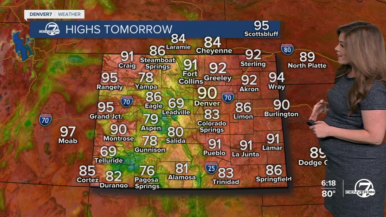
Who's ready for the summer heat?! It'll be a sizzling start to July as daytime highs skyrocket into the lower 90s along the I-25 corridor. Look for mostly sunny skies early with increasing afternoon clouds and an isolated storm. A few stronger cells are possible along the far northeastern corner of Colorado
The sunshine and heat stick around mid-week with highs in the low to mid 90s across the plains. Wednesday looks mainly hot and dry for the plains.
Scattered storms return Thursday afternoon as potential tropical moisture streams into the state. Storms could be a bit more widespread later in the day and into the evening.
Look for near-normal highs on the 4th of July in the upper 80s. Isolated storms will be in the forecast, so you might have to run indoors briefly from your Independence Day BBQs. Keep an eye to the sky as a few storms will be possible through the holiday weekend.
DENVER WEATHER LINKS: Hourly forecast | Radars | Traffic | Weather Page | 24/7 Weather Stream
Click here to watch the Denver7 live weather stream.
