


DENVER — We're not out of the woods just yet. Fire danger concerns will escalate again Friday as strong winds move across the Front Range mountains, foothills, Denver metro and plains. The good news is wet weather and cooler temperatures are back for the weekend, helping to alleviate the fire danger threat.
Look for mostly clear skies tonight along with a breeze out of the northwest. Overnight lows will dip into the 20s in the High Country with low to mid 30s in the Denver metro area.
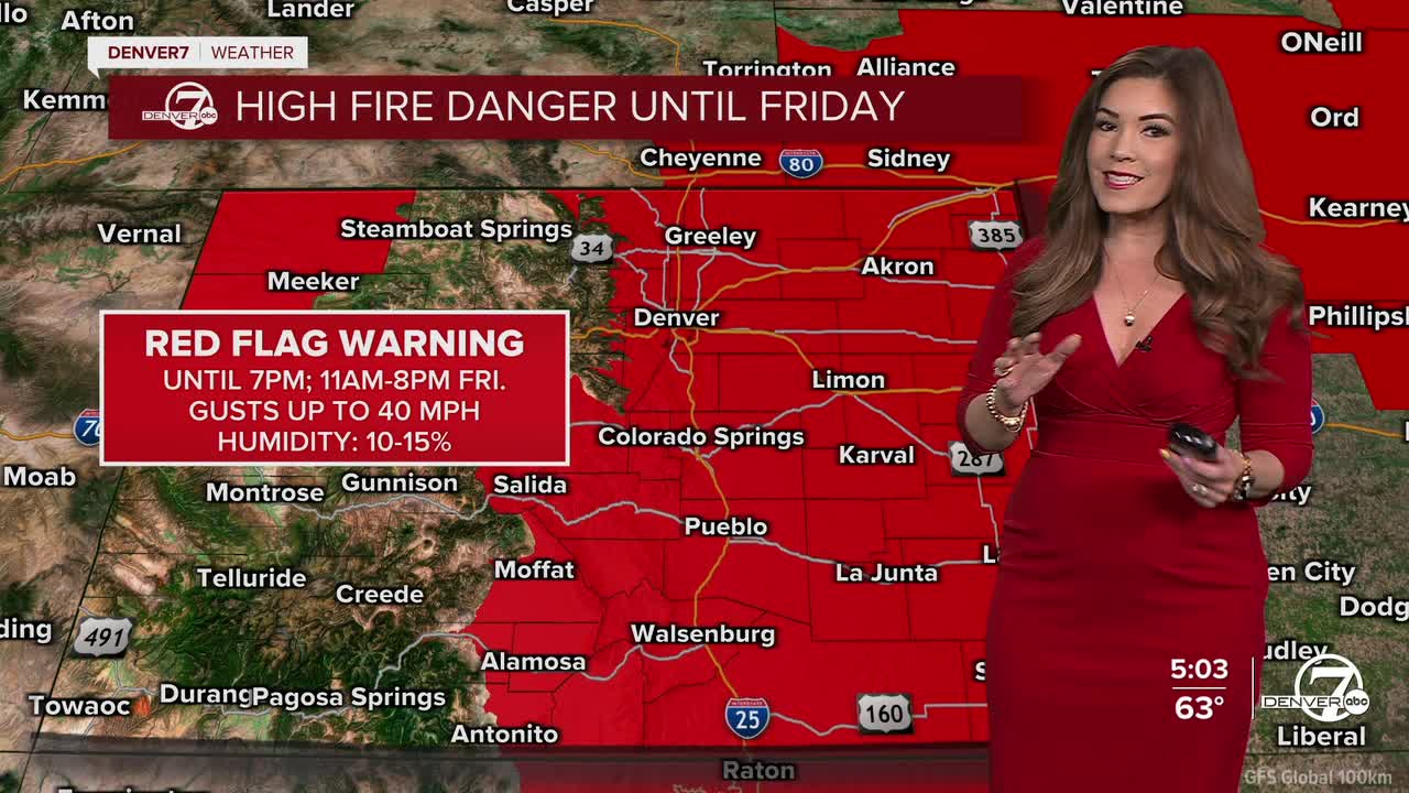
It'll be a sunny start to your Friday but the winds quickly make a comeback by the early afternoon. A Red Flag Warning will go back into effect for the Front Range and Eastern Plains at 11 a.m. until 8 p.m. Friday. Winds will gust up to 40 mph with humidity values as low as 10 percent. Daytime highs will be a bit warmer to end the week, in the low to mid 70s along the Interstate 25 corridor.
Another round of storms move into Colorado over the weekend. The mountains will see another shot of light snow while the Denver metro will see a few scattered showers Saturday with a better chance of rain and possibly a few thunderstorms on Sunday.
The relatively cooler and unsettled weather sticks around for the start of next week. We'll get a brief, sunny break Tuesday with more rain returning mid-week.
DENVER WEATHER LINKS: Hourly forecast | Radars | Traffic | Weather Page | 24/7 Weather Stream
Click here to watch the Denver7 live weather stream.
