


It was a cool and soggy Memorial Day weekend, and the wet weather sticks with us, with more storms and showers through tonight.
We will see a marginal risk for severe weather particularly south and east of Denver through tonight. Hail, pockets of moderate to heavy rain and strong winds are all possible through 9pm.
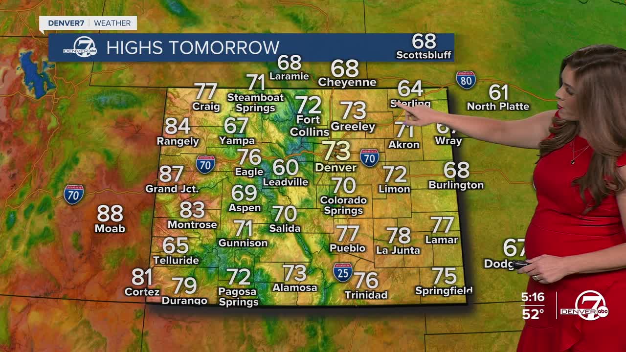
If you're ready for a bit more sunshine, the forecast starts to improve as we head into the short work week. Look for temperatures to bounce back closer to seasonal averages, with highs returning to the 70s for the Denver metro Tuesday afternoon. It’ll still be unsettled, though, with the chance of typical late-day showers or thunderstorms — nothing severe expected, just those familiar pop-up storms we often see this time of year.
There will still be enough moisture to fuel afternoon showers and storms Wednesday and Thursday, especially over the higher terrain and along the foothills. Mornings will be generally dry, giving you a good window for outdoor activities if you plan early. Daytime highs will stay in the upper 60s to low 70s.
Warmer, drier weather returns to the Front Range Friday and into the weekend. Look for highs in the low 80s Friday with mostly sunny skies. It'll be a seasonal start to the weekend with upper 70s Saturday and mid-80s Sunday. It looks like the 80+ degree heat sticks around into early next week.
DENVER WEATHER LINKS: Hourly forecast | Radars | Traffic | Weather Page | 24/7 Weather Stream
Click here to watch the Denver7 live weather stream.
