


DENVER — The weather stays pretty quiet and mild across the Front Range tonight. Most areas stay dry with comfortable evening temperatures. It’s a calm setup before a much more active stretch begins.
Monday will be the transition day. It will still feel fairly mild, especially early, but by the afternoon you can expect scattered showers and a few thunderstorms to pop up, first in the mountains and then drifting onto the plains. By Monday evening, a cold front slides in, and that’s the signal that a bigger, more impactful storm is about to take over.

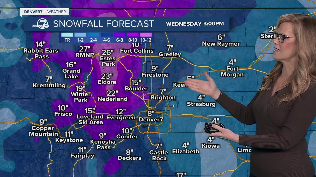
From Monday night through Wednesday, a significant spring snowstorm is expected, especially for the Front Range mountains and foothills. These areas are likely to pick up heavy snow, with over a foot possible in higher elevations and even locally higher totals. Travel in the mountains could become difficult, particularly late Tuesday into early Wednesday, when snowfall rates may be heaviest.

For the I-25 corridor and nearby plains, confidence is increasing that most places will see snow. The big question is how much sticks.
Right now, several inches look possible for many areas, especially Tuesday night into Wednesday when temperatures are more favorable. There is also a chance of higher totals if bands of snow become intense. Wet snow on fully leafed trees could lead to some localized issues if the higher-end scenario plays out.

By the second half of the week, things should turn around pretty quickly.
The colder air pulls out, and temperatures rebound back to more typical, even slightly warmer-than-normal levels.
While a few passing showers can’t be ruled out, the overall pattern looks much calmer and more spring-like again.
DENVER WEATHER LINKS: Hourly forecast | Radars | Traffic | Weather Page | 24/7 Weather Stream
Click here to watch the Denver7 live weather stream.
