


DENVER — It's a noisy night along the Eastern Plains and strong to severe storms continue to rumble off to the east. Look for intense lightning, heavy rain and even some hail tonight.
Most storms clear out after midnight across the state with partly cloudy skies lingering overnight. Lows will dip into the low to mid 50s early Wednesday morning.
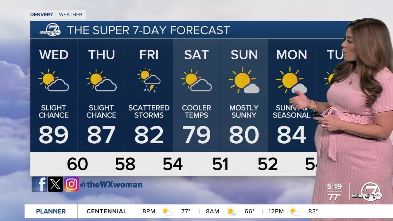
Lather, rinse, repeat! Wednesday will bring more of the same, with mostly sunny skies and another warm afternoon. Highs will soar into the mid to upper 80s, with a very slight chance of an isolated storms later in the day.
It'll be a partly cloudy, breezy day on Thursday with highs in the mid to upper 80s. Scattered storms are likely in the mountains with just a slim chance of an afternoon storm around the Denver metro.
A cold front will drop into the state early Friday, helping to cool off daytime highs into the upper 70s to lower 80s. The city will see a better chance of scattered afternoon and evening storms.
By the weekend, temperatures will continue to trend slightly cooler, with highs in the upper 70s Saturday and low 80s Sunday.
DENVER WEATHER LINKS: Hourly forecast | Radars | Traffic | Weather Page | 24/7 Weather Stream
Click here to watch the Denver7 live weather stream.
