


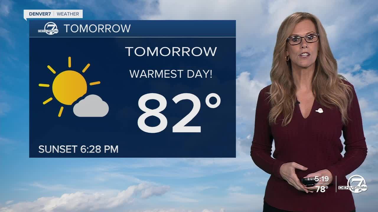
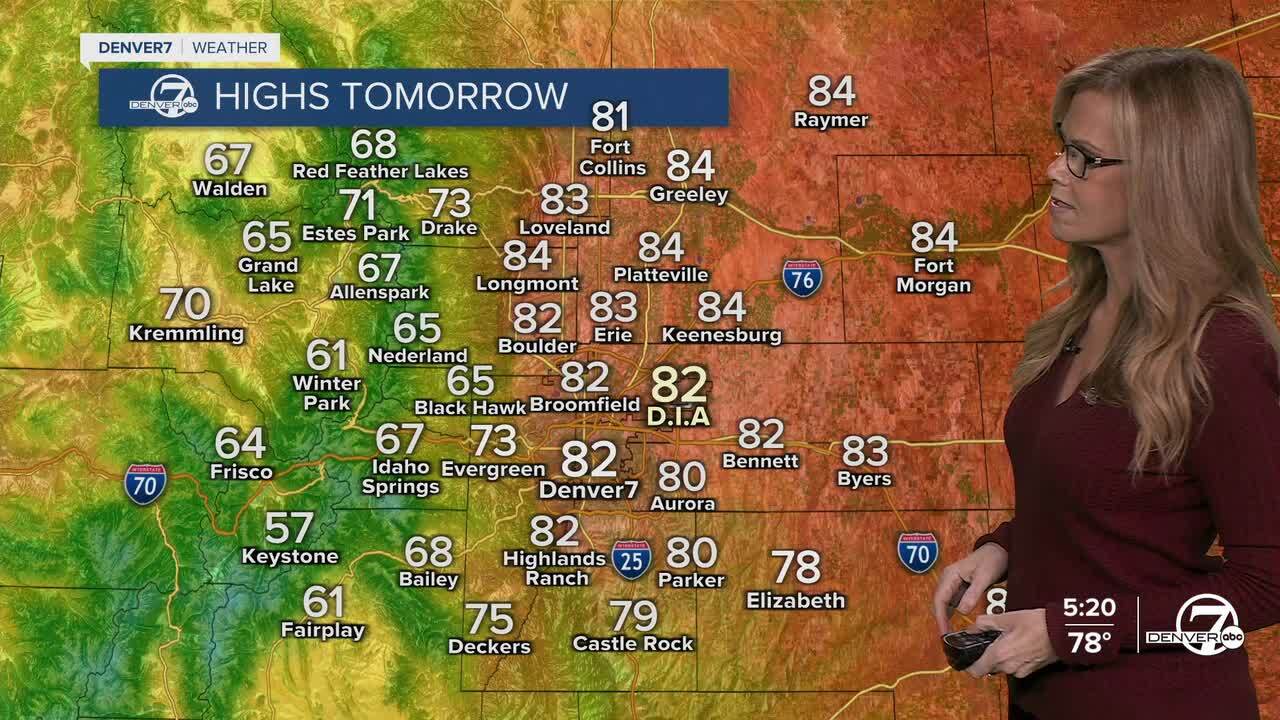
DENVER — Starting tonight, you can expect the warm and dry weather to continue across the region. Skies will stay mostly clear, and overnight lows will be mild for this time of year. The warm pattern sticks around through Thursday, thanks to high pressure sitting over Colorado. Thursday looks to be the warmest day of the week, with highs climbing into the low to mid 80s, which is well above normal for early October. (68 degrees is our average high)

Friday brings a shift in the pattern as a storm system begins to push inland from the Pacific, drawing in moisture from the remnants of Hurricane Priscilla. This increase in moisture will lead to scattered showers and isolated thunderstorms, especially in the mountains and foothills. While the plains may stay mostly dry during the day, a weak disturbance moving through Friday afternoon and evening will increase the chance for a few storms to pop up, especially in northeastern Colorado.
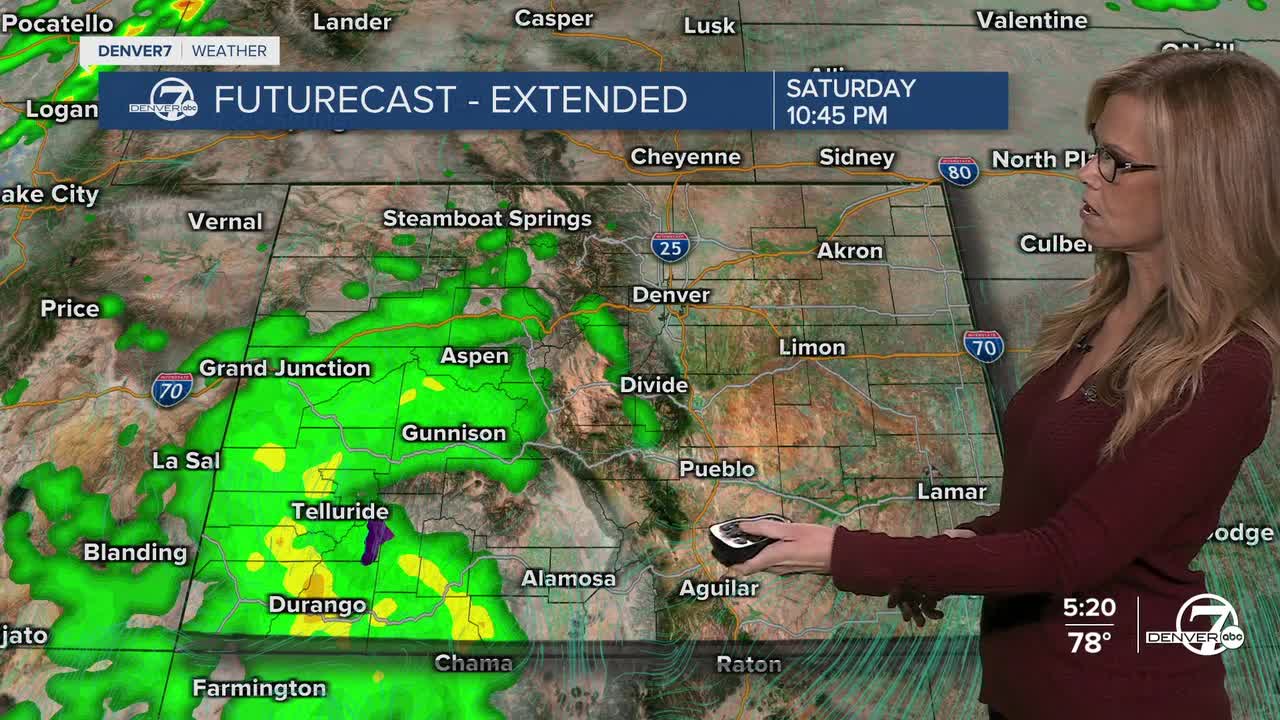
Heading into Saturday, expect more clouds overhead and cooler temperatures compared to Thursday, though it will still be warmer than average. The rain chances continue across the high terrain, with occasional showers possible over the plains. With moisture still lingering and a few weak disturbances moving through, it won’t be a washout, but you’ll want to keep an eye on the sky, especially in the mountains. SW Colorado will remain under a Flood Watch from Thursday until Saturday night for flooding concerns.
By Sunday, a cold front is expected to move through, bringing a noticeable cool-down and shifting the moisture eastward. The mountains could see some rain or even light snow, depending on elevation, while the plains are likely to stay drier with breezy west winds. Temperatures will drop closer to normal for this time of year, marking the end of the recent warm streak.
Looking into early next week, the weather becomes less certain. Another upper-level system could develop off the Pacific Northwest, but models disagree on its exact path and strength. For now, it looks like temperatures will hover near or just above normal, with occasional chances for showers, especially in the mountains. Stay tuned, as the forecast may shift depending on how this next storm develops.
DENVER WEATHER LINKS: Hourly forecast | Radars | Traffic | Weather Page | 24/7 Weather Stream
Click here to watch the Denver7 live weather stream.
