


After a mostly dry and breezy weekend, we're looking at some changes in the weather pattern starting Monday. Tonight will remain calm with seasonable temperatures and mostly partly cloudy skies. Winds will stay fairly light overnight, mostly out of the south-southeast. For northern Colorado, into Greeley, Loveland and Ft. Collins a Frost Advisory is in effect from 3am to 8am Monday morning. Bring in or cover and vulnerable vegetation.

By late Monday, moisture will begin to move into the area, especially across the mountains and far northeastern plains. Expect a few scattered rain and snow showers to pop up in the higher elevations, while the eastern plains may see some light rain by late afternoon or evening. It’s nothing major, but enough to bring a bit of variety to our otherwise dry stretch.
Tuesday looks to be mostly dry again, with only limited moisture sticking around. We'll stay under a southwest flow aloft, which means temps will remain pretty close to average for this time of year. Don’t expect much in the way of rain, but it could still be breezy at times, especially across the plains.
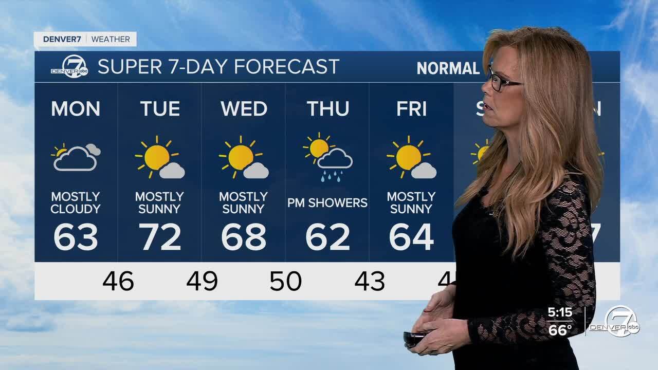
By Wednesday, temperatures will begin to climb a bit above normal as we stay under a dry and gusty south-southwest flow. Winds could be noticeable again, especially in the afternoon. Later in the evening and into Thursday morning, a cold front is expected to move in, bringing back better chances for rain and snow showers, mainly in the mountains, and possibly some light rain over the plains as well.
Looking toward the weekend, the forecast becomes a bit more uncertain. One model keeps things dry with near-normal temperatures, while another hints at another round of moisture moving in by Saturday. For now, it looks like we’ll lean toward a mostly dry weekend with comfortable fall temperatures, but stay tuned in case that changes.
DENVER WEATHER LINKS: Hourly forecast | Radars | Traffic | Weather Page | 24/7 Weather Stream
Click here to watch the Denver7 live weather stream.
