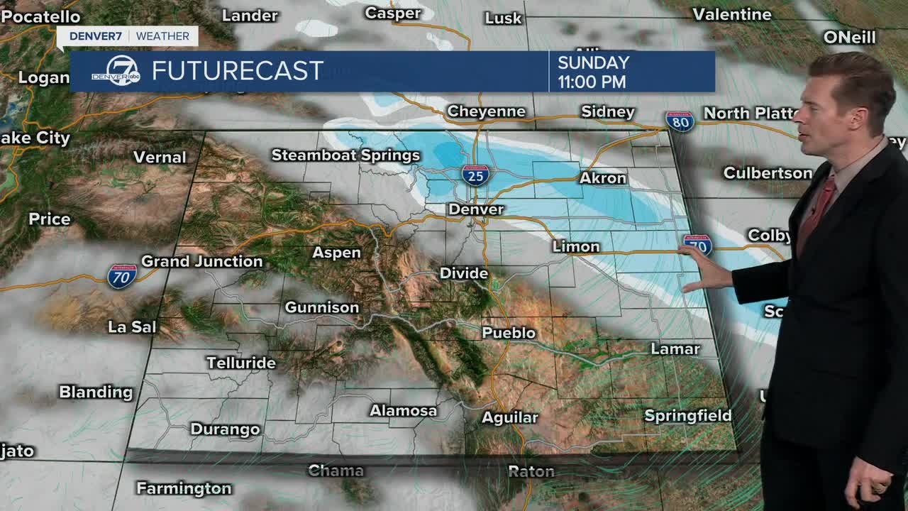


DENVER — Sunday looks good with sunshine and warm highs around 50 degrees. But, a fast moving cold front races into Denver and the Front Range late Sunday with snow.
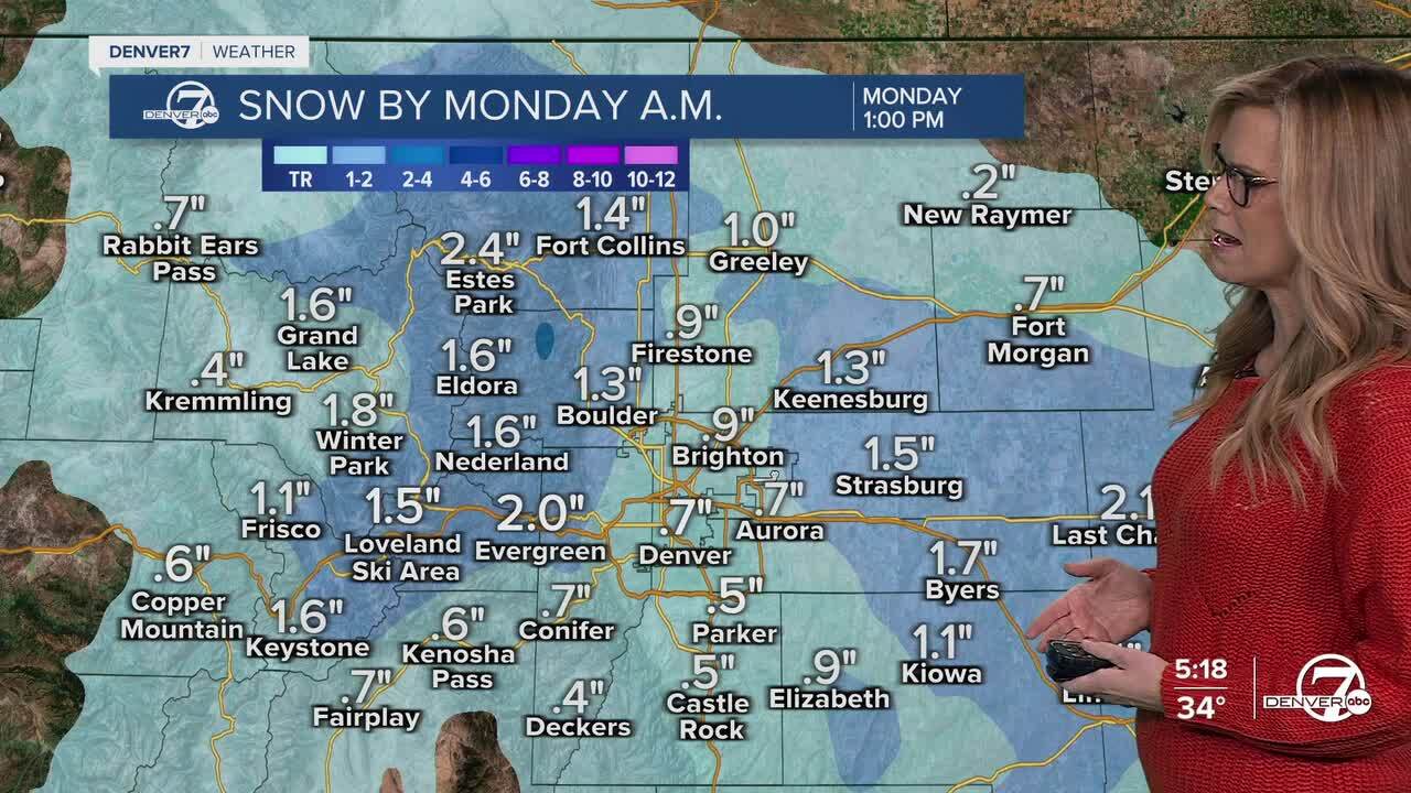
Snow develops around 11pm Sunday and then tapers off around 6am on Monday morning. Expect a wet and possibly slick morning rush hour. Snow accumulation looks light with most places under 1 inch. Then skies will turn sunny across the Front Range.
The Foothills and Mountains can expect 1-2 inches of total snow accumulation. High temps on Monday drop 10 degrees to about 40 in Denver. Mountain highs in the 20s and teens.
After that system moves out, things calm down nicely. From Tuesday through much of the rest of the week, weather looks fairly tranquil and dry. We’ll stay in a northwest flow pattern, with temperatures bouncing around a bit above and below normal and only a few minor chances for very light snow. Overall, no major weather impacts are expected beyond Monday morning.
DENVER WEATHER LINKS: Hourly forecast | Radars | Traffic | Weather Page | 24/7 Weather Stream
Click here to watch the Denver7 live weather stream.
