


DENVER — If you haven’t felt that true chill of fall yet — you’re about to.
After a few showers and gusty winds this evening, skies will clear overnight.
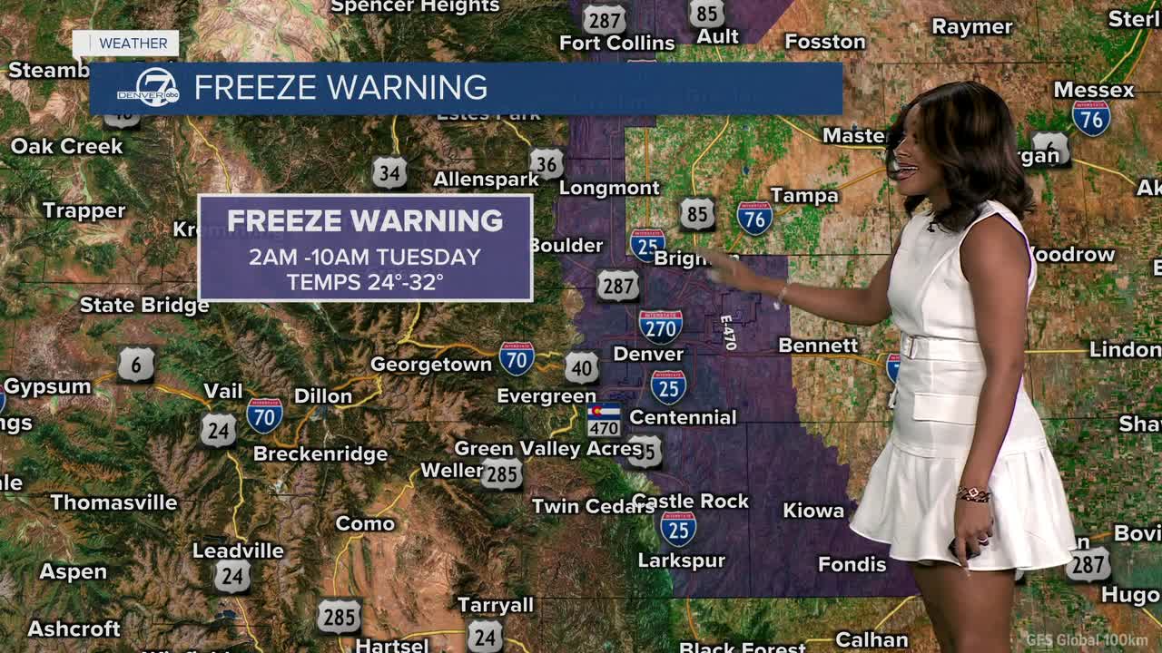
Freezing temperatures are likely across much of the Front Range tonight, including Denver, Boulder, Fort Collins, and Castle Rock. A freeze warning is in effect from 2-10 a.m. Tuesday, and again from 10 p.m. Tuesday to 10 a.m. Wednesday.

Lows will dip into the mid-20s to low 30s Tuesday morning, then plunge even colder by Wednesday morning, bottoming out in the upper teens to mid-20s.

For many, this will be the hard freeze that ends the growing season.
Winds shift from the north to northwest and stay breezy into Tuesday, especially across the plains where gusts may reach 30 to 40 mph.
Expect a much cooler day Tuesday with highs in the upper 40s to near 50 degrees.

By Wednesday, the chill really settles in — a cold but quiet start before sunshine helps temperatures rebound into the mid to upper 50s by the afternoon.
Looking ahead, the rest of the week stays dry and cool, but by Friday, temperatures begin to warm back up, setting the stage for a milder weekend ahead.
Grab that heavier jacket, bring in your plants, and get ready for the coldest stretch of the season so far!
DENVER WEATHER LINKS: Hourly forecast | Radars | Traffic | Weather Page | 24/7 Weather Stream
Click here to watch the Denver7 live weather stream.
