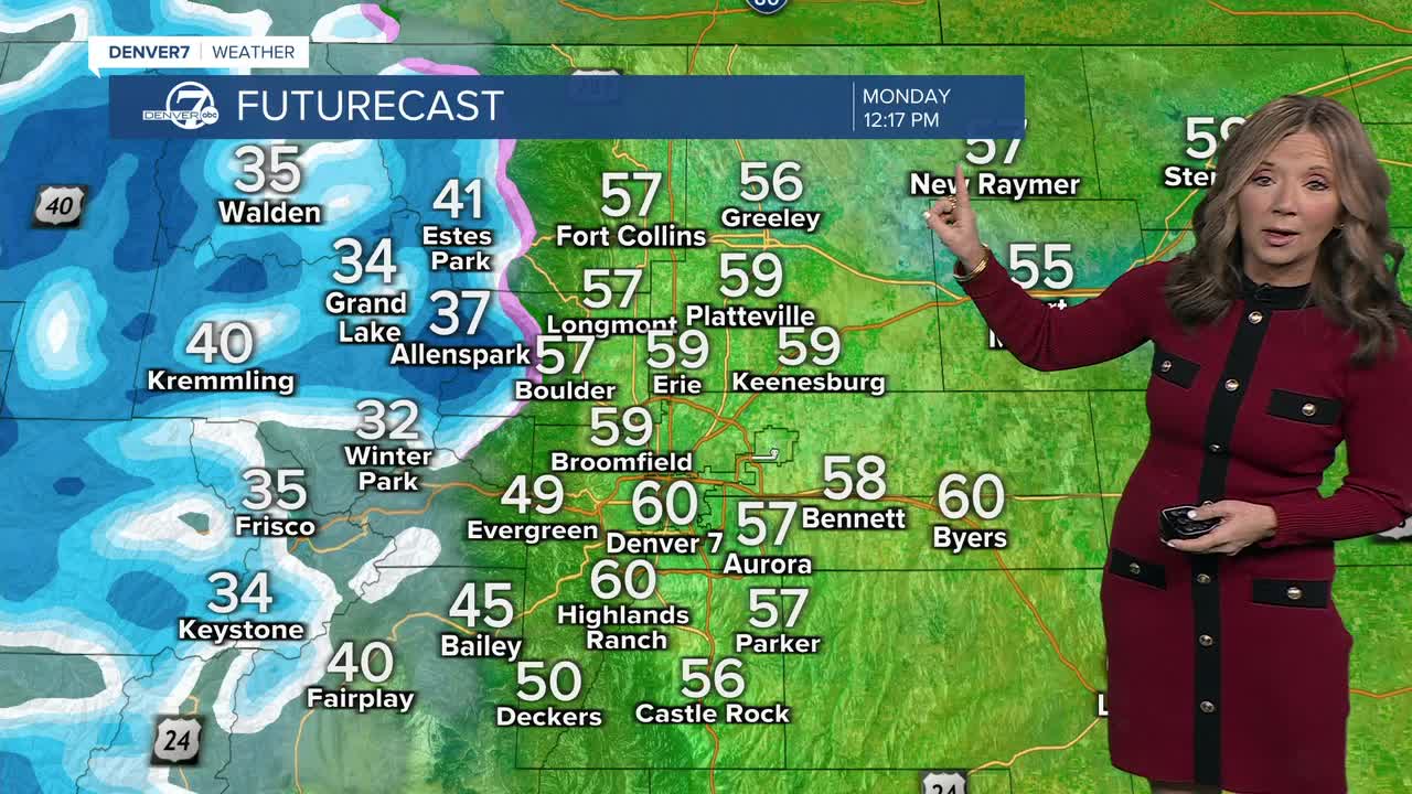


DENVER — We are starting the week with mild and breezy conditions.
However, changes are on the way as colder air and snow chances return for Colorado later in the week.
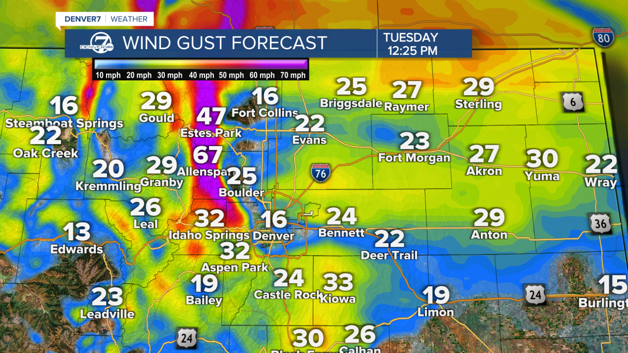
As of now, winds will stay active, especially along the Front Range and I-25 corridor.
Wind gusts are expected to continue through Tuesday, keeping fire weather concerns elevated.
Despite the breeze, above-average temperatures are expected to stick around just a little bit longer.
Tuesday afternoon highs will climb into the upper 50s and low 60s.
Wednesday will have lighter winds, but mild temperatures stick around.
Big changes arrive Thursday as colder air moves in.
Plus, Snow chances return, mainly for the mountains, with a possibility of light snow elsewhere depending on how the system develops.
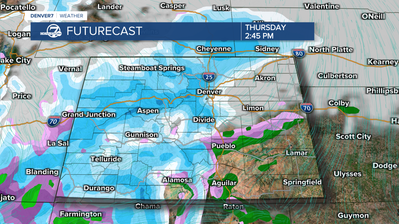
Friday is expected to be noticeably cooler with highs in the 30s.
Temperatures will be much colder compared to earlier in the week, with a chance of lingering snow for the lower elevations.
DENVER WEATHER LINKS: Hourly forecast | Radars | Traffic | Weather Page | 24/7 Weather Stream
Click here to watch the Denver7 live weather stream.
