


DENVER - Partly cloudy skies take over the Front Range overnight with lows dipping into the low 60s. A cold front will push through the region, dropping temperatures quite a bit mid-week.
This front will bring a nice 10 to 15 degree cool down, with highs in the low upper 70s to low 80s on Wednesday afternoon. It'll be a mostly cloudy and smoky start to the day around the Front Range with storms firing up in the later afternoon.
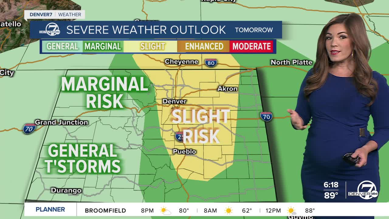
The Denver metro area and plains will see more widespread and possibly severe storms Wednesday starting around 2pm. So far, the Storm Prediction Center has the I-25 corridor and eastern plains under a slight risk of severe storms. Large hail, damaging wind gusts and isolated tornadoes will be the biggest threats across the Front Range Wednesday.
Temperatures will warm a few degrees to the mid 80s Thursday along with a few afternoon storms. So far, it looks like the threat of severe weather will be much lower Thursday.
By Friday, the heat will start to creep back in, with temperatures climbing back into the 90s and the usual pattern of afternoon storms returning. It won’t be a total washout over the weekend but storm chances will continue each day. Keep your umbrella or rain jacket nearby just in case something drifts over your area in the afternoon or evening!
Mid-90s and sunny skies are back early next week.
DENVER WEATHER LINKS: Hourly forecast | Radars | Traffic | Weather Page | 24/7 Weather Stream
Click here to watch the Denver7 live weather stream.
