


DENVER — It looks like it will be an unseasonably warm start to February. We saw high temperatures in the low 60s across the metro area on Sunday and it's going to get even warmer in Denver later this week!
We saw some increasing clouds overnight but that's leading to an incredibly mild morning. The clouds act like a blanket, trapping in some of the heat that we saw on Sunday. You'll find lows in the 30s and 40s Monday morning, with low 50s by lunch and highs in the upper 50s by 4 p.m. Northeasterly winds will pick up behind the front, with occasional gusts around 20 to 25 mph before easing later in the day.
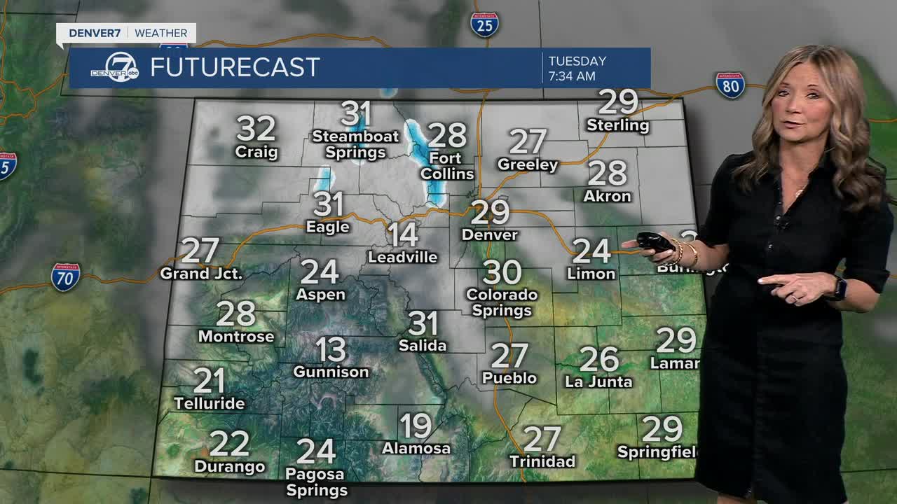
Tuesday cools down a bit more, with highs mainly in the upper 40s to low 50s under northwest flow aloft. By Tuesday night into early Wednesday, a passing weather system brings the next chance for snow, though confidence isn’t especially high for the metro area. We'll likely see a light rain/snow mix develop Tuesday afternoon. The best chance of snow will be in the northern/central mountains and potentially south along the Palmer Divide.
Temperatures will stay on the cool side, but still seasonable, with highs generally in the mid 40s to lower 50s. By later in the day, sunshine should return as drier air moves back in. From Thursday through next weekend, the pattern turns warm and dry. A strong ridge of high pressure builds over the region, pushing temperatures back up into the upper 50s and mid 60s. Aside from maybe some passing high clouds at times, the end of the week and the weekend look quiet, mild and precipitation free.
DENVER WEATHER LINKS: Hourly forecast | Radars | Traffic | Weather Page | 24/7 Weather Stream
Click here to watch the Denver7 live weather stream.
