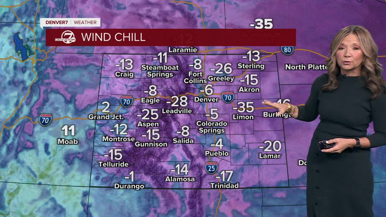


DENVER — It's a bitterly cold start to the day. Temperatures have dipped into the single digits, with wind chills at about 20 to 30 degrees below normal. We will see lots of sunshine across the state and that will quickly help to improve the roads.

Downsloping winds will help temperatures climb into the upper 30s to mid 40s on the plains. However, gusty winds will develop in and near the foothills, especially Monday morning. With light, fluffy snow on the ground, areas of blowing snow and poor visibility are possible, particularly along Highway 93.
Monday night through Tuesday will remain mostly dry. A weak disturbance may bring a few light snow showers to the mountains on Tuesday, but most lower elevations will stay dry with seasonable temperatures. Travel impacts outside of the mountains are expected to be minimal during this time.
From Wednesday onward, a warming trend is expected as high pressure builds in. Conditions will stay dry with temperatures rising above normal, especially on the plains. Another weak system could bring a chance of snow to the mountains late Wednesday night into Thursday, but overall, the pattern looks quieter and milder compared to the start of the week.
DENVER WEATHER LINKS: Hourly forecast | Radars | Traffic | Weather Page | 24/7 Weather Stream
