


Relief from the heat is finally here! After three days of temperatures in the upper 90s, we're in for a major cool down for the next couple of days.
Storms are moving off the plains tonight as mostly cloudy conditions set in overnight. Temperatures will dip into the lower 60s overnight. Another early morning cold front races into the state, reinforcing the cooler air in place along the Front Range.
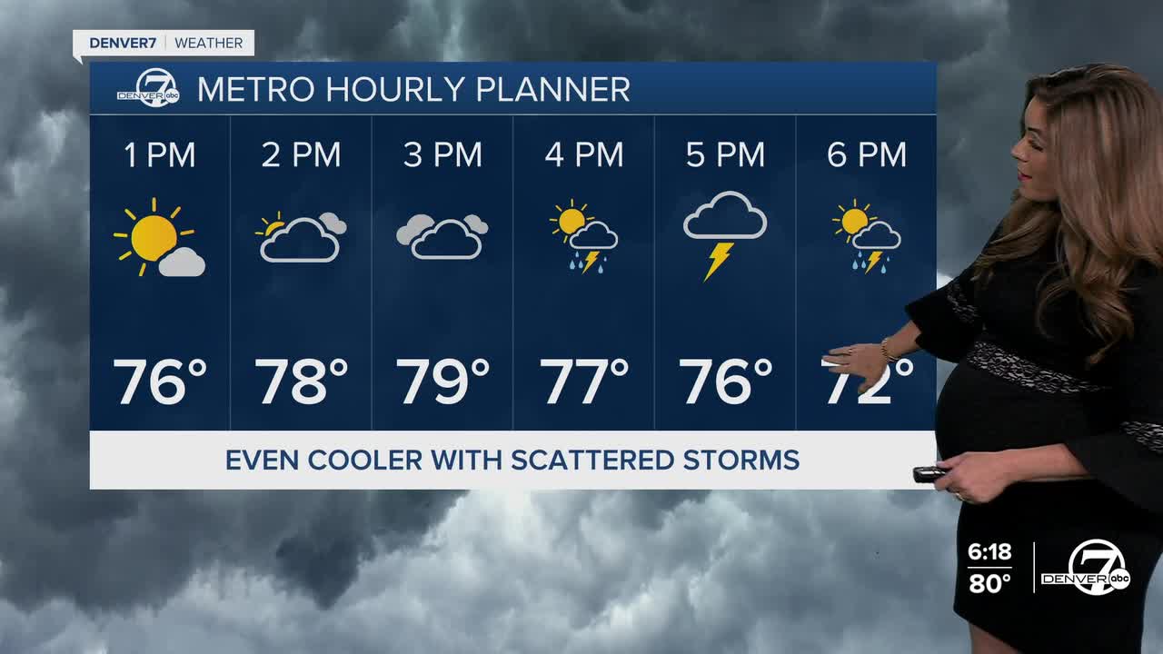
Another round of storms with possibly heavy rainfall is expected Wednesday afternoon and evening across the Denver metro area and plains. Much of the I-25 corridor is under a marginal risk of severe storms. Flash flooding, large hail and damaging wind gusts will be the biggest threats Wednesday.
Daytime highs will again be noticeably cooler, in the upper 70s to low 80s on Wednesday and Thursday. Afternoon and evening storms will stick around the rest of the work week.
Looking ahead to the weekend, conditions are expected to dry out and warm up. With the ridge shifting directly overhead, highs will climb back into the 90s for the plains and Denver metro area, with fewer storms for the northeastern plains.
The dog days of summer hold on for the first full week of August!
DENVER WEATHER LINKS: Hourly forecast | Radars | Traffic | Weather Page | 24/7 Weather Stream
Click here to watch the Denver7 live weather stream.
