


DENVER — After a "cooler" day in the mid to upper 70s, look for a few storms and showers to cross the I-25 corridor this evening. There's a low risk of severe weather for the Denver metro area tonight with a few potential stronger storms on the far Eastern Plains.
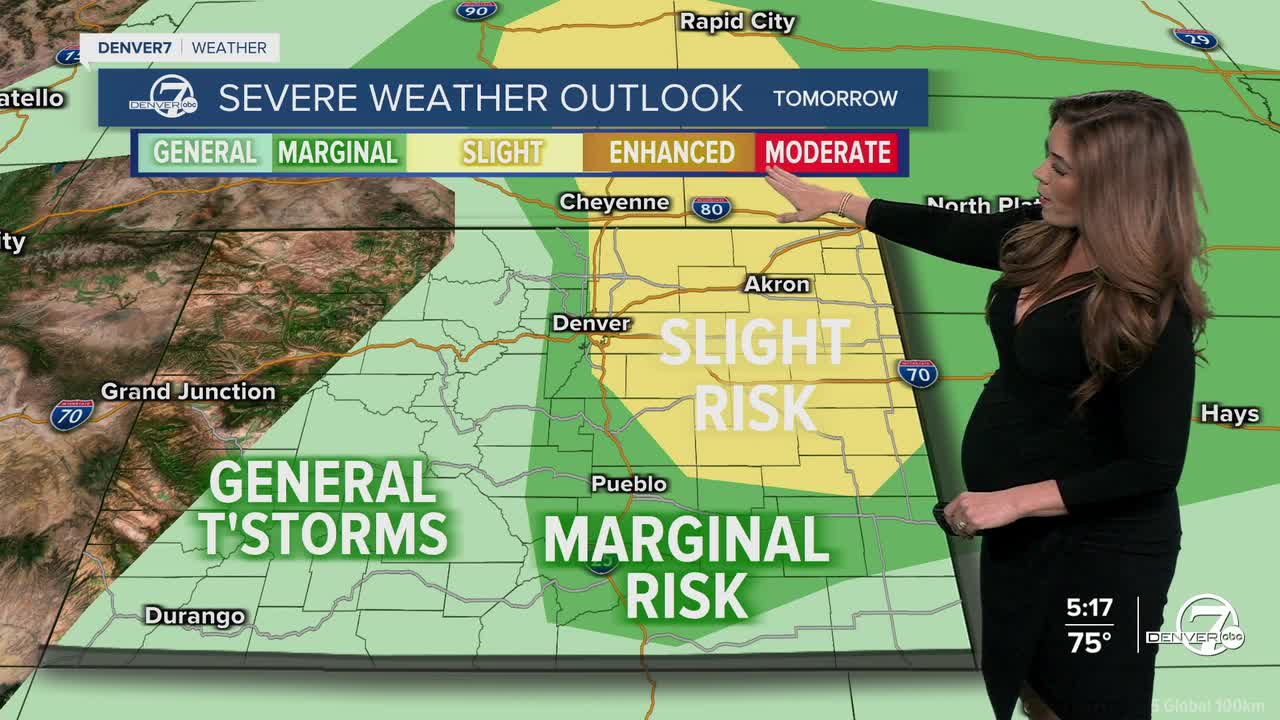
This unsettled weather pattern will stick around through midweek. Severe storms could pop up as early as 2pm around the Denver metro and the Interstate 25 corridor on Tuesday. These storms will be capable of producing large hail, damaging wind gusts up to 60+ mph and isolated tornadoes on the plains. Keep the cars in the garage, if you can!
Temperatures will remain below normal with highs in the upper 70s to low 80s on Tuesday and Wednesday. It will be a bit more seasonal on Thursday, with highs in the mid to upper 80s.
A ridge of high pressure rolls back into Colorado to end the work week as more typical summer weather returns to the state. Look for mostly sunny skies and just a slight chance of a late-day storm, mainly over the mountains. The plains will stay pretty dry from Thursday through Sunday.
As for the heat, it’ll be making another comeback. After our brief cool down early in the week, expect highs to climb back into the upper 80s and low 90s Thursday through the weekend. So enjoy the cool down and the rain while it lasts — the summer heat will return before you know it.
DENVER WEATHER LINKS: Hourly forecast | Radars | Traffic | Weather Page | 24/7 Weather Stream
Click here to watch the Denver7 live weather stream.
