


DENVER — Showers and storms are rumbling across parts of Colorado this evening with the potential for a few severe cells on the far Eastern Plains. Large hail and damaging winds up to 75 mph will be the biggest threats along with blowing dust and brownout conditions.
We are updating this Colorado weather blog with the latest weather alerts.
Seeing severe weather in your community? Send us a photo or video at newstips@denver7.com.
Stay alert if you’re in an area that is under a watch or warning, and keep an eye on radar as storms develop and move east. The Denver7 News team is tracking the latest severe weather alerts and storm reports below.
LINKS: Latest forecast | Radars | Traffic | Weather Page | 24/7 Weather Stream
Tuesday, June 30
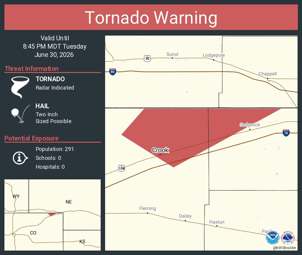
8:20 p.m. | Tornado warning | NE Logan and NW Sedgwick Counties are under a tornado warning until 8:45 p.m. Read NWS alert here.
8:12 p.m. | Severe thunderstorm warning | Baseball-sized hail is possible in a severe storm near Julesburg and Sedgwick, according to the NWS. A severe thunderstorm warning is in effect until 9 p.m.

7:50 p.m. | Tornado spotted near Iliff | A tornado warning has been issued for Northeastern Logan and Southwestern Sedgwick Counties until 8:30 p.m. Spotters confirmed a tornado and baseball-sized hail is possible.
