


UPDATE | 11:45 a.m. — The Spring Creek Fire is now 2,925 acres and is still 20% contained.
...
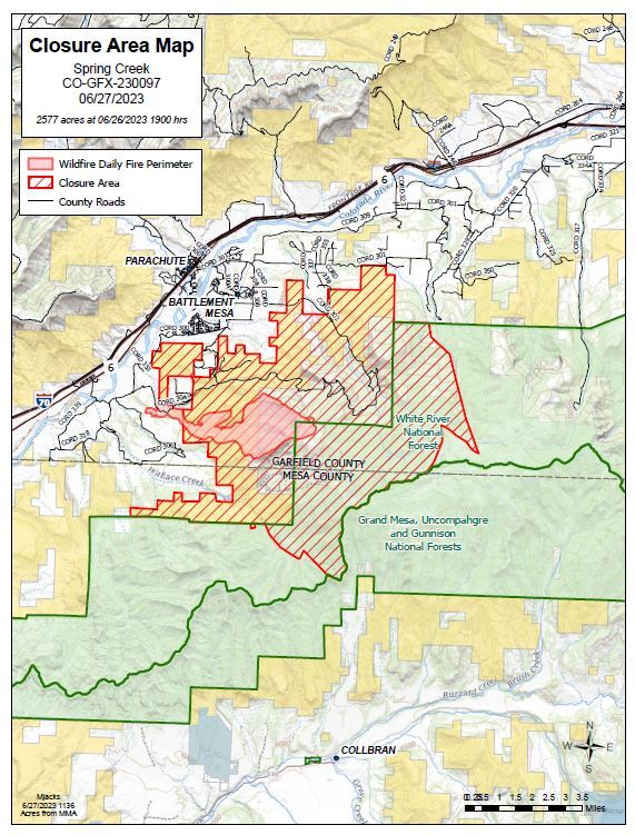
GARFIELD COUNTY, Colo. — The Spring Creek Fire has grown to 2,859 acres and is 20% contained as of Wednesday afternoon, authorities reported.
More than 350 fire personnel are working around the blaze, which broke out on June 24 southwest of Parachute. That day, firefighters and aerial crews worked to keep fires to about 200 acres on a mix of private land and Bureau of Land Management land. The fire grew on June 26, when hot, dry and windy conditions pushed it to grow beyond 2,500 acres.
The Rocky Mountain Area Complex Incident Management Team, which said this is "a full suppression strategy fire," took over command around 6 a.m. Wednesday from the Upper Colorado River Interagency Fire Management Unit.
As firefighters continue to protect the values at risk, more resources have been arriving to the scene to help. Crews have been strategizing the best places to construct direct and indirect fire lines. Helicopters are also working around the fire.
Firefighters are focusing on the northeast side of the fire closest to Parachute, where there is oil and gas infrastructure, the management team said.
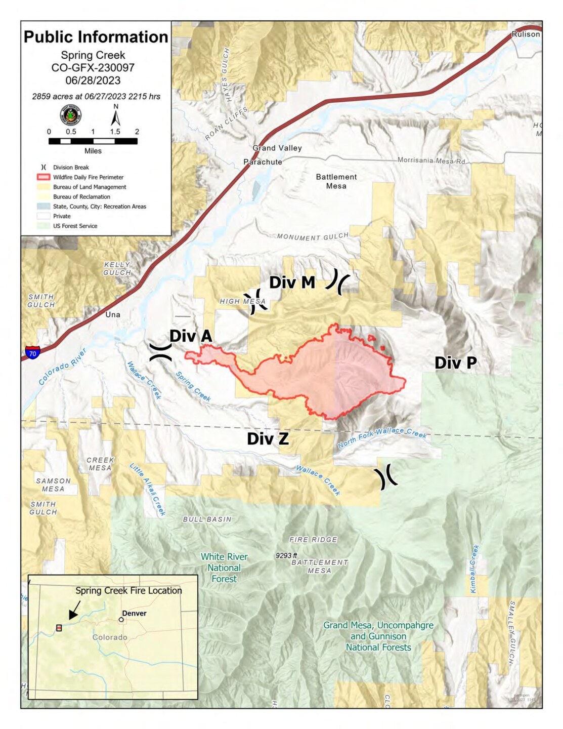
Spring Creek Road and High Mesa Road are closed to the public, but open to local traffic.
A red flag warning is in effect for the area above 7,500 feet until 8 p.m. Tuesday. Wind gusts may blow 20 to 30 mph. This wind is blowing the wildfire smoke around, which might impact residents, the management team said.
The Colorado Department of Public Health and Environment said an air quality health advisory is in effect for southern Garfield County and northern Mesa County until 9 a.m. Thursday due to the smoke impacts. Smoke may move east and northeast of the fire Wednesday with periods of moderate to heavy smoke in Rulison, Rifle, Antlers and Silt, the CDPHE said. Heavier smoke is possible late Wednesday through early Thursday as it settles in lower elevations. On Thursday morning, the worst smoke impacts will likely be along Interstate 70 between Parachute and De Beque.
Officials are reminding the public that there is a temporary flight restriction in the air space over the fire, meaning drones are not allowed to fly in the area. If officials see a drone, they are forced to ground all of their aircraft.
No evacuations have been ordered. To sign up for emergency alerts in Garfield County, visit GarCo911.com.
The cause of the fire remains under investigation.
For specific questions about the Spring Creek Fire, call 970-414-1772, email 2023.spingcreek@firenet.gov or visit the Facebook page created to share information about the fire.

