


Heavy rain and strong storms Tuesday may bring moderate to high risks of flooding around three of Colorado's significant burn scars.
Afternoon and evening thunderstorms are likely along the Front Range on Tuesday, with possible heavy rain over the burn scars from the 2024 Alexander Mountain Fire, 2024 Stone Canyon Fire and 2020 Cameron Peak Fire. To date, the Cameron Peak Fire is the biggest wildfire on record in Colorado at more than 208,000 acres.
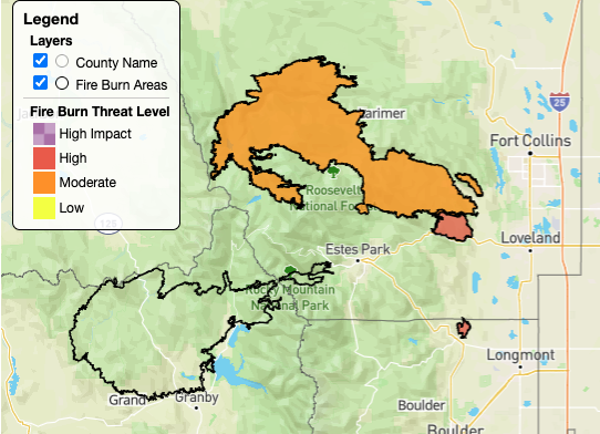
The Alexander Mountain and Stone Canyon burn scars are both under a "high" threat, with Cameron Peak under a "moderate" threat, according to the Colorado Flood Threat Bulletin.
A flash flood warning was issued around 11:40 a.m. until 2:15 p.m. for central Larimer County — including the Cameron Peak burn scar and Glen Haven — after a radar detected a thunderstorm with heavy rain near Pennock Pass moving east about 10 mph. Flash flooding "is ongoing or expected to begin shortly" there, the NWS reported. The flooding will be strong enough to endanger anybody in its path, the NWS said.
Burn scars are particularly susceptible to rainfall, because the precipitation that would normally be absorbed by the ground will instead run off the burned soil, which can be as water-repellent as pavement, the National Weather Service (NWS) said. The scientific term for it is “hydrophobicity," as Peter Nelson, associate professor in the Department of Civil and Environmental Engineering at Colorado State University, explained to Denver7 last summer.
This can lead to a flash flood and dangerous conditions downhill and downstream from the burned area.

Denver7 | Weather
Storms move out tonight; warmer, drier weather returns to Denver Wednesday
These threats can persist for years after a wildfire, the NWS said, with the great susceptibility of a flash flood within the first two years after a blaze.
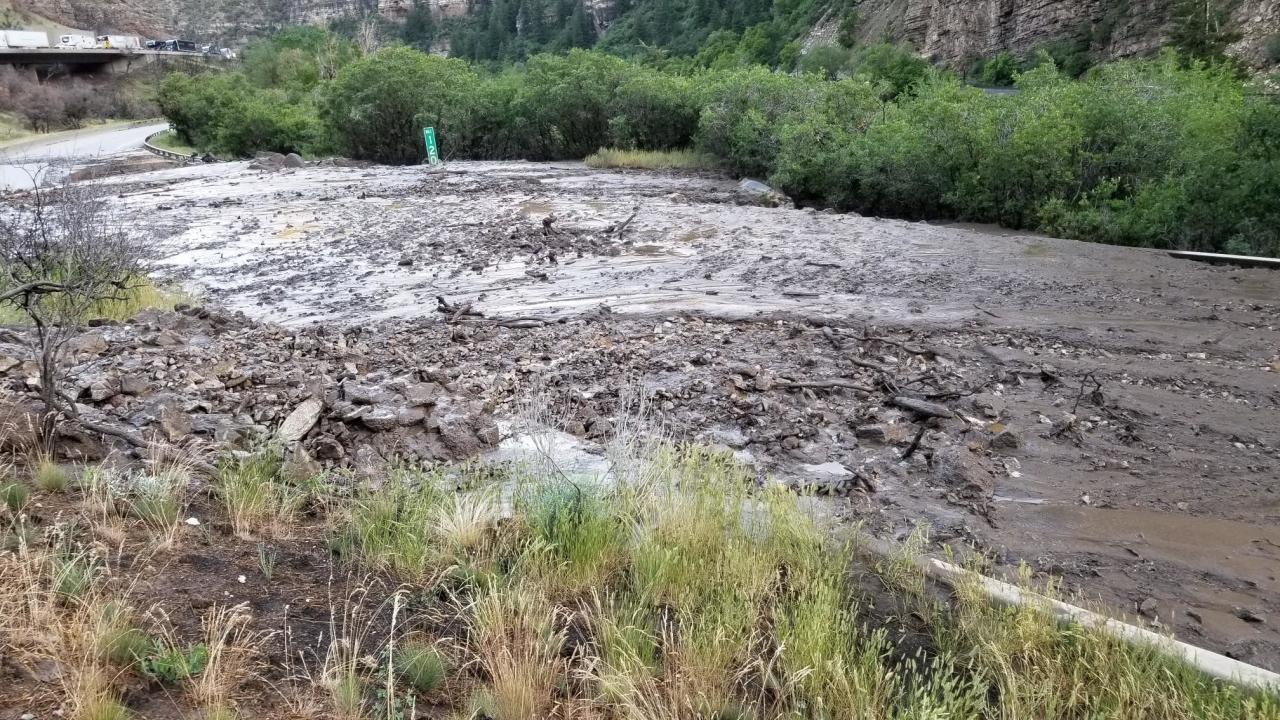
In some cases, the flooding takes the shape of a debris flow, which are fast landslides made of mud, rocks, boulders, trees and other debris, the NWS said. It is difficult to say when they may start, which is why flood warnings near burn scars can become extremely dangerous very quickly.
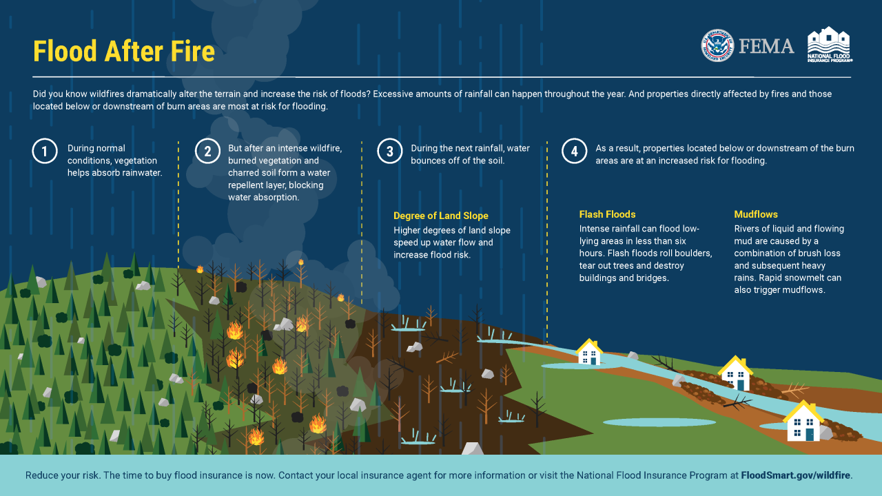
"Debris flows occur most commonly during intense rain after wildfires," the NWS said. "A debris flow doesn't need a long rain or a saturated slope. It can start on a dry slope after only a few minutes of intense rain... A general rule of thumb is that half an inch of rainfall in less than an hour is sufficient to cause flash flooding in a burn area, but this can be more or less."
If you live downhill from a burn scar, keep an eye out for any flash flood warnings or evacuation orders. If you are surprised by a debris flow, get to high ground as quickly as possible. This can include on a roof, up a slope, or in a tree.
The state recommends that residents protect their homes with flood insurance, which is not typically included in standard homeowner's policies. An average flood policy costs about $600 a year in moderate- to low-risk areas, according to the state.

Denver7 | Weather
Why is flooding worse near wildfire burn scars, and what can be done about it?
Nelson explained to Denver7 last summer that he is part of a group that researches how mulch — dropped by helicopters after a wildfire — not only helps reseed the forest, but can reduce erosion and, therefore, debris flows. The early research showed that its success depends on where the mulch is placed and how much is dropped.
"So far, I think our takeaways from that research are that the sooner you can do it, the more likely it is to be successful," Nelson said. "The greater amount of mulch that you can apply to a hill slip of concern, the more likely it is to be effective."
The stormy conditions Tuesday will be brief, with much hotter and drier weather moving in toward the end of the week, with temperatures appearing likely to reach triple digits. The Colorado Flood Threat Bulletin said a few records may be tied or broken.
