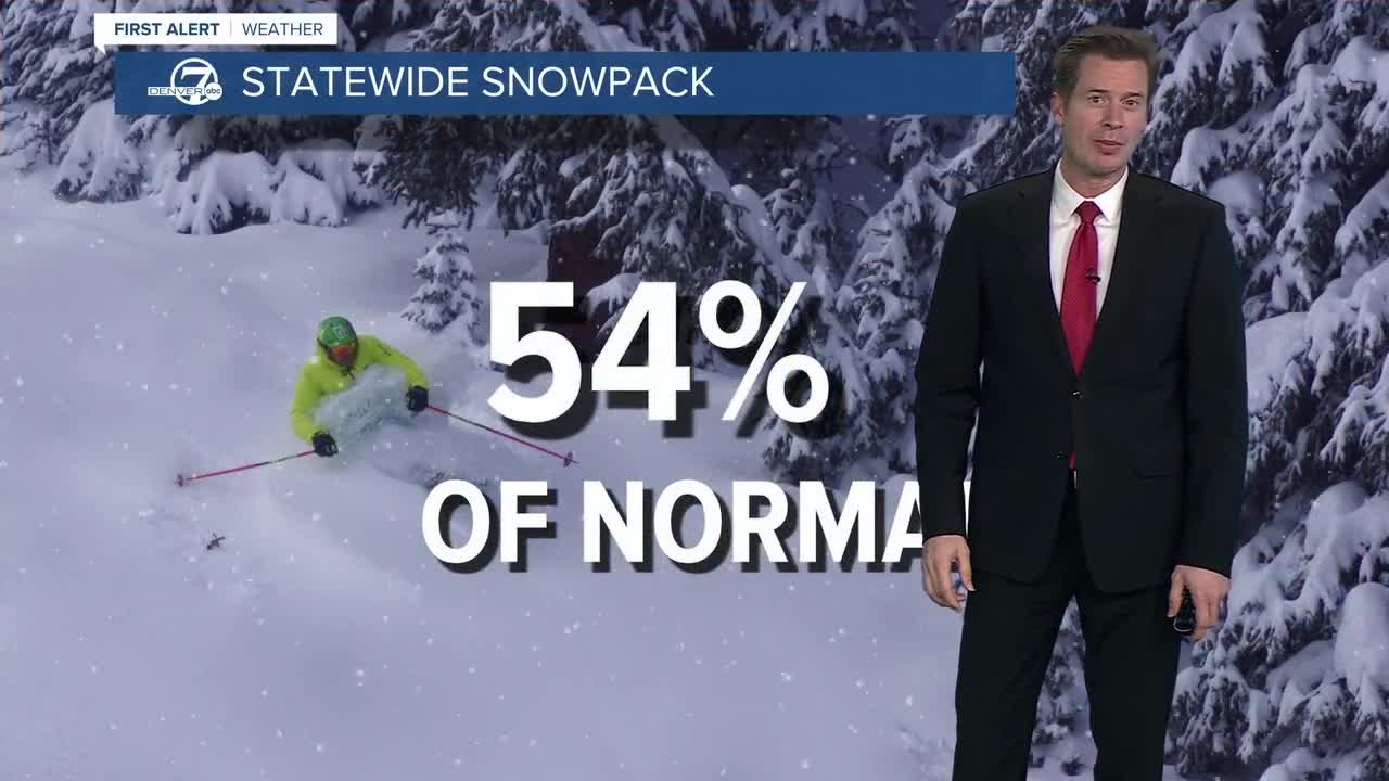


DENVER — Statewide snowpack in Colorado was 54% of the median as of Friday — tied for the worst snowpack on record as we kick off the winter season.
Snowpack is the amount of water stored in snow in the mountains. According to Denver Water, Coloradans get about 80% of their water supply for household and agricultural uses from snow, so it is crucial to monitor it each year.
Below is a graph showing the snow water equivalent in Colorado as of Friday. The black line shows our current state.

The Colorado Avalanche Information Center broke down a snowpack analysis by region:
- In the northern mountains: Snowpack is "generally weak and beat up"
- In the central mountains: Snowpack varies from "rain-soaked dirt where a snowpack existed a day ago" at low elevations to "frozen, supportive crust on a thin snowpack."
- In the southern mountains: Snowpack "is not great enough for (Christmas Day) rain to present significant problems."
Denver7 Meteorologist Chris Tomer explained that each winter month delivers about 20% of the total snowpack, so if December fails to deliver that, it becomes increasingly difficult, though not impossible, to make it up.
What does this mean exactly for Colorado's ski mountains? Take Vail for example. The resort's back bowls and Blue Sky Basin are both closed and the mountain has less than 20% of its total trails open. Loveland Ski Area has about 62 inches of total snow this year, which is about 2 to 3 feet of snow below what is normal for this time of year. It should be closer to 120 inches, Tomer said, with a normal season delivering 320 inches.
The below map shows the percentage of median snow water equivalent and illustrates the percent of normal amount of snowpack for each river basin.
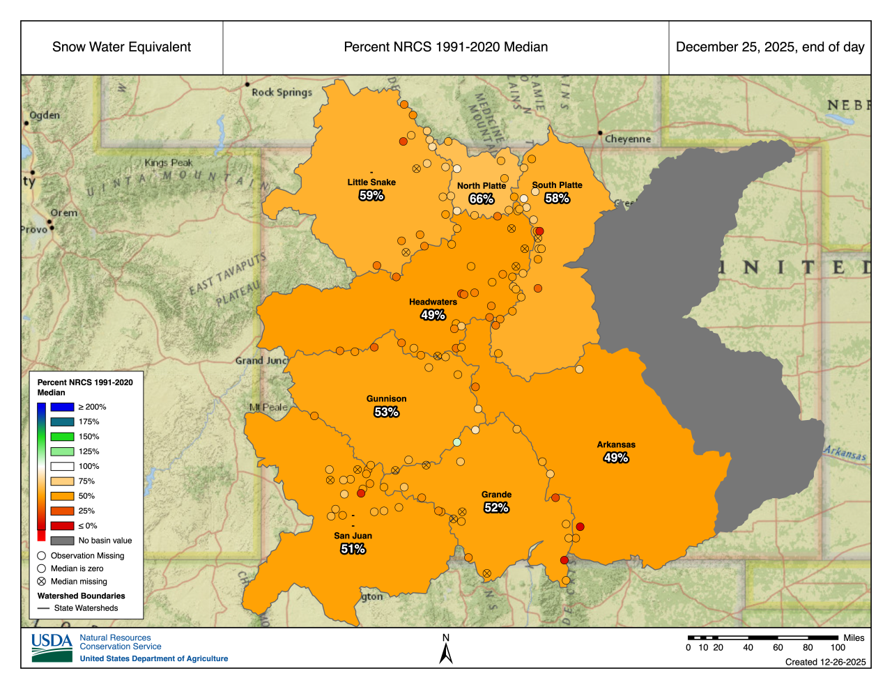
Brian Domonkos, hydrologist with the U.S. Department of Agriculture’s Natural Resources Conservation Service, explained that it's always good to see snowpack between 100% and 120% so it's high enough to avoid water shortages but low enough to not pose a flood risk.
Hear more from Denver7 Meteorologist Chris Tomer in the video below.
❄️ Looking ahead to weekend snow ❄️
Our next strong cold front will hit the mountains on Saturday.
The good news is this strong cold front will drop between 4 and 12 inches of snow in Colorado's mountains, including at ski areas. The heaviest snow amount is expected in the Park and Gore mountain ranges, according to the National Weather Service (NWS) out of Boulder.

Today's Forecast
Cold air stays in place tonight, warmer weather ahead
It moves into Denver late in the day into Sunday morning, bringing about 1 to 3 inches of accumulation across the I-25 corridor and just a bit less farther east on the plains. The snow will wrap up around 10 a.m. Sunday in Denver and sunny skies will move back in.
However, the cold temperatures remain, with single digits possible on Monday morning.

