

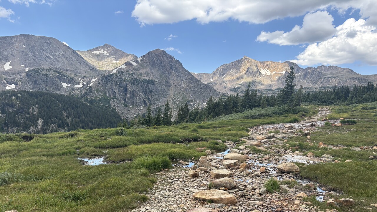


The Indian Peaks Wilderness protects lakes, peaks, a glacier and incredible scenery. One of the best hikes for wildflowers and history is Lake Dorothy. It sits in a bowl below several peaks, including Mount Neva.
The hike starts at the Fourth of July Trailhead. The trailhead has limited parking, so it’s best to come on a weekday or very early on a weekend.
The trail immediately goes into the forest and starts gaining elevation. In the first mile or so, you’ll walk on boardwalks, climb rock steps and cross over cascading waterfalls. When the forest opens up, enjoy the views of the peaks surrounding this valley.
You may also hear, or glimpse, a waterfall across the valley. That’s the outflow of Diamond Lake.
At 1.2 miles, you’ll come to a trail split. This is where you turn left for Diamond Lake and right for Arapahoe Pass. The signs never say Lake Dorothy, so it’s good to have a map downloaded from AllTrails and/or COTREX.
The Arapahoe Pass Trail continues to climb uphill through the willows and water. The hillside trail is known for its beautiful, wildflower-filled meadows and peak views.
After climbing about 1,100 feet in elevation from the parking lot, the trail flattens out. You’ll likely be walking through and around some shallow water up here, but it’s nice to catch your breath.
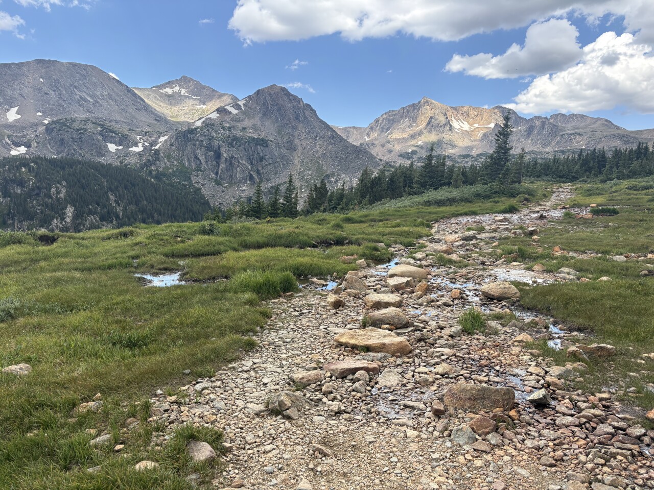
Just over two miles from the trailhead is your second trail split. This is the turnoff for the Arapaho Glacier Trail. For Lake Dorothy, we continue straight ahead on the Arapahoe Pass Trail.
But first, look around. You may notice some heavy equipment and mining dump piles. This is the area of the old Fourth of July mine. Named because it was claimed on Independence Day 1882. When you’re done wandering around, return to the main trail.
At this point, you’ve climbed just over half of the elevation gain for Lake Dorothy.

When you get above the treeline (where the trees stop growing), you’ll see the trail contouring around the valley and uphill. That’s your trail. It’s easy to follow, but not easy to walk. It’s all rock and scree. You may notice a series of ponds in the valley below you. I counted at least eight. The COTREX map didn't list names for any of them.
At 3.3 miles, you’ll come to a sign. Hikers going to Arapahoe Pass and Caribou Lake turn right here. But for Lake Dorothy, turn left on the Caribou Pass Trail.
But before you start uphill, walk to the cliff edge in front of you — that’s Caribou Lake down there. And make sure you look at the trail down to Caribou Lake. It has a lot of switchbacks! Caribou Lake is very popular with backpackers.
When you’re done enjoying the view, head uphill to the left. It’s just a short walk to another trail split. Go left here to go to the Lake Dorothy shore. Go right to stay on Caribou Pass Trail and get a view of the lake from above.
Now you have options. You can have lunch and enjoy Lake Dorothy and head back. Or continue on the Caribou Pass Trail a short distance for a view of Grand Lake. Or go even further for a view of the other side of the Continental Divide and even Winter Park’s ski runs. Or head down to Caribou Lake.

Details: the hike to Lake Dorothy is 7.2 miles roundtrip with about 2,000 feet of elevation gain,
Directions: Google Fourth of July Trailhead. It's four miles past the Hessie Trailhead, where you'll likely see a long line of parked vehicles.
If you have any questions, or hike suggestions, email me at HikingDebbie@gmail.com and find more great hikes by following me on Facebook at Facebook.com/DenverHikingExaminer.