



One of the best hikes in the Indian Peaks Wilderness is Diamond Lake. There are fields of flowers, peak views, waterfalls and a scenic lake.
The hike starts at the Fourth of July Trailhead, named for a nearby mine, and is a bit beyond the popular Hessie Trailhead. But the adventure starts before the hike. That's because the dirt road to the Fourth of July Trailhead is typically only open in the summer and it can get rough. It isn't suitable for all vehicles. Plus, with limited parking, sometimes the parking area can fill before 7 a.m.
At the trailhead is a small campground, pit toilets and signs explaining the wilderness rules, like keeping your dog on a leash and picking up after them. Another sign says Diamond Lake is just two miles away, but it's actually closer to three.

The hike starts on Arapahoe Pass Trail No. 904 and it immediately starts uphill. If you find yourself struggling to catch your breath, that's because the trailhead is at 10,000 feet.
You'll hike through the forest with an occasional boardwalk. When the trees open up, take a moment to catch your breath and enjoy the views of the nearby peaks. Two of the highest are Mount Neva (12,814 feet) and Mount Jasper (12,923 feet).
There are two water crossings on this trail and you may notice a waterfall on the hillside across the valley — that's the outflow from Diamond Lake. Yes, you'll be going up there.
At 1.25 miles you'll come to a trail split. Hikers going to Arapahoe Pass, Lake Dorothy, the Fourth of July mine and Caribou Lake will turn right here. For Diamond Lake, we're going left.
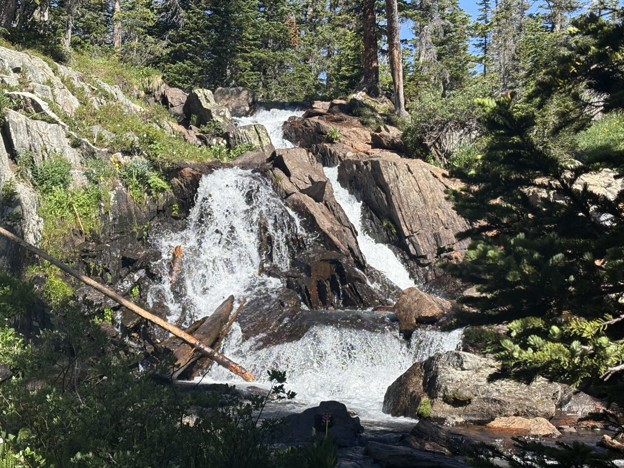
After all that elevation gain, this next section of trail has a couple ups and downs as it winds through forest. It's a little over a half mile to an unexpected waterfall. I say unexpected because it doesn't have a name, but it's worth a stop, especially when the wildflowers are blooming next to the creek.
When you're done taking pictures, you'll cross a nearby bridge and turn left to stay on the Diamond Lake Trail. It's about another mile and another 350 feet in elevation gain to Diamond Lake. When you see the sign that says "Diamond Lake Travel Zone," you'll be close.
The next sign can be confusing. An arrow points right for Diamond Lake and an arrow pointing left for the Diamond Lake Trail. That's because the Diamond Lake Trail goes on to Jasper Lake and other points. For this hike, turn right — and pass the sign for various campsites — to the lake.
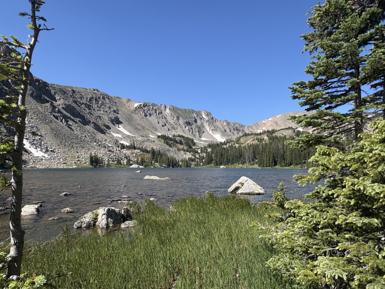
Diamond Lake is in a bowl below several peaks at 10,940 feet. While the shoreline is a bit marshy, there are rocks in the trees that make a great spot for lunch and rocks by the shore that are great for enjoying the sun.
If you want to go farther, make sure you have a map from AllTrails and/or COTREX because the trail to Upper Diamond Lake is faint and can be easy to lose.
Details: The hike to Lower Diamond Lake is about 5.8 miles with 1,100 feet of elevation gain.
Directions: Google Fourth of July Trailhead. It's four miles past the Hessie Trailhead, where you'll likely see a long line of parked vehicles.
If you have any questions, or hike suggestions, email me at HikingDebbie@gmail.com and find more great hikes by following me on Facebook at Facebook.com/DenverHikingExaminer.