


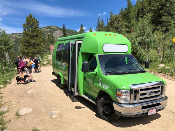
BOULDER COUNTY, Colo. — A free shuttle to a popular Boulder County trailhead, notorious for extremely limited parking options, will begin its seasonal service on Friday.
The Hessie Trailhead Shuttle is available on Fridays, weekends and holidays through the summer and fall. It brings passengers from Nederland High School, at 597 County Road 130, about four miles farther west on Eldora Road to the Hessie Trailhead (on Aug. 14, the pickup spot will switch to the Nederland Park-n-Ride instead of the school).
Watch Boulder County reporter Colin Riley's report here:
Visitors can also park in Boulder at the Downtown Boulder Station (1800 14th St.) and Boulder County Justice Center (1777 6th St.) for free on weekends and holidays, and ride the RTD bus route to connect with the Hessie Shuttle in Nederland.
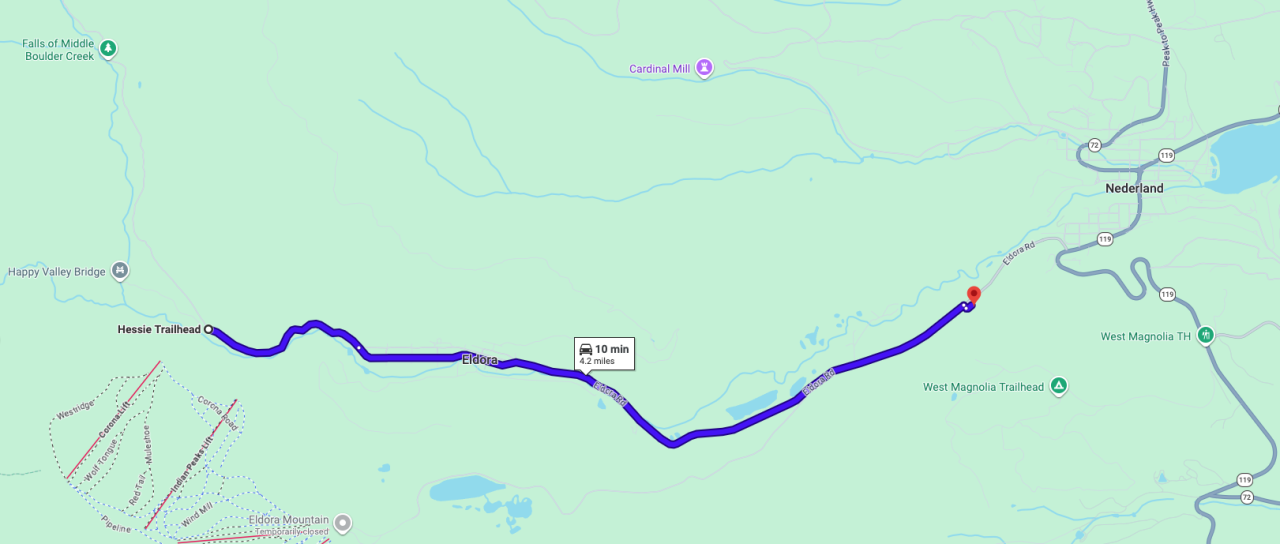
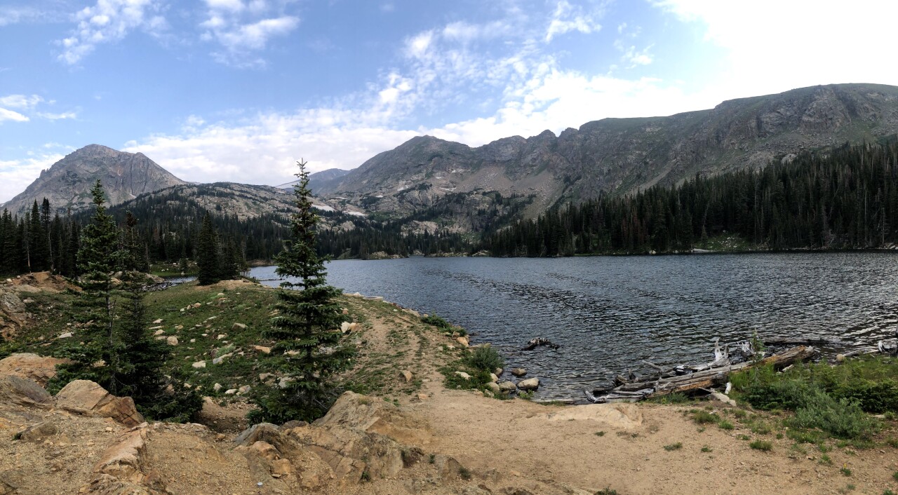
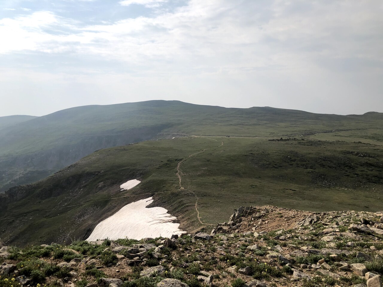
The Hessie Trailhead is a well-known access point to the Indian Peaks Wilderness, which includes Devils Thumb, Lost Lake, King Lake, Woodland Lake and Diamond Lake trails. It also leads to the Continental Divide Trail, a 3,000-mile hike between Mexico to Canada. About 750 of those miles are in Colorado.
We have a list of some beautiful hikes from this trailhead at the bottom of this story.
In 2025, about 48,000 people visited the Hessie Trailhead, according to Boulder County Parks & Open Space. The busiest month was July.
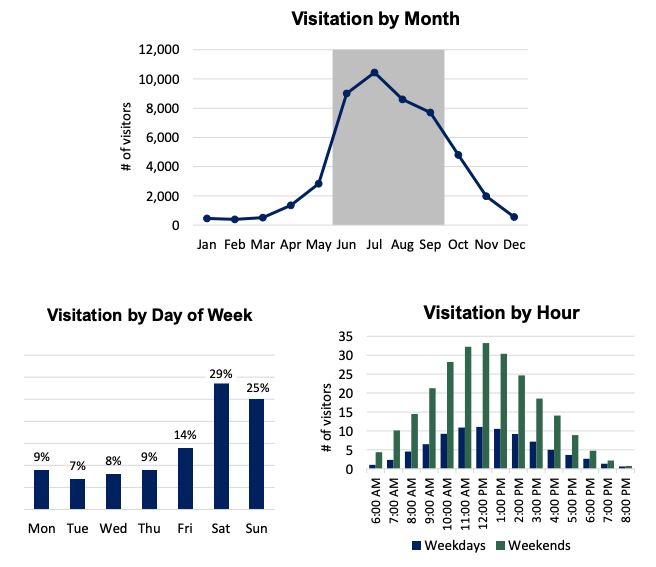
The Hessie Trailhead Shuttle will start service at 6 a.m. each Friday, Saturday and Sunday. The last shuttle back to the high school is at 6 p.m. Fridays and Sundays, and 8 p.m. on Saturdays. Saturday's final shuttle will bump back to 6 p.m. on Sept. 12.
Here is the shuttle's holiday schedule:
- Sunday, May 24: 6 a.m. – 8 p.m.
- Monday, May 25 (Memorial Day): 6 a.m. – 6 p.m.
- Friday, June 19 (Juneteenth): 6 a.m. – 6 p.m.
- Friday, July 3: 6 a.m. – 8 p.m.
- Sunday, Sept. 6: 6 a.m. – 8 p.m.
- Monday, Sept. 7 (Labor Day): 6 a.m. – 6 p.m.
It departs every 15 minutes. No reservations or passes are required to ride the shuttle. While dogs are welcome on the shuttle, bikes are not allowed.
The shuttle does not run Monday through Thursday.

In addition to day hiking, overnight camping is also popular here. Permits are required for all overnight trips between June 1 and Sept. 15. They cost $5 per group.
If you visit this area, the U.S. Forest Service offers these reminders:
- Dogs must be on a leash at all times
- Campfires are prohibited year-round
- Campsites must be 100 feet away from water and trails
- Group sizes are limited to 12
- Wildlife is plentiful here, including moose. Give them plenty of space
- There are no restrooms at the Hessie Trailhead
- Parking is only allowed between the signs. Violators will be fined $50 and/or towed.
The free shuttle will end its service on Oct. 11.
Here are some beloved hiking routes from the Hessie Trailhead.
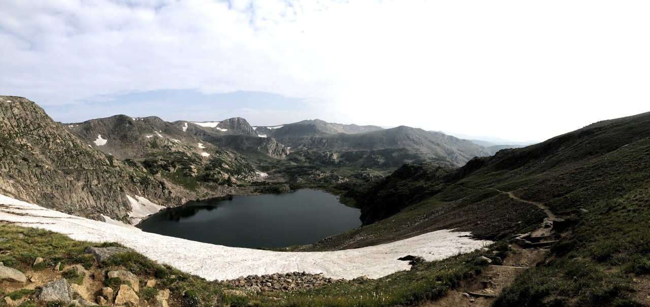
Lost Lake (~4.2 miles)
This is arguably the most-visited spot for visitors at the Hessie Trailhead. Over the span of about 2 miles, hikers will gain about 830 feet in elevation, ending at Lost Lake. Then, you have 2 miles back downhill.
To get there, take the Devil's Thumb Trail that splits to the left from the trailhead — make sure you don't head up the Fourth of July Road. Keep left at the Devil's Thumb Bypass trail intersection and again at the spur off to King Lake. The lake is about 0.4 miles after that latter intersection.
This is also a well-known spot for snowshoeing in the winter.
King Lake (~12 miles)
If you're headed to King Lake, start on the same trail as Lost Lake (Devil's Thumb Trail) but once you're about 1.7 miles from the trailhead, turn right instead of continuing to Lost Lake.
Over the following four miles, you will gain about 1,200 feet in elevation. Once you reach the switchbacks, you are about a mile away from the lake.
King Lake sits at about 11,500 feet, so expect wind and cooler temperatures (the trailhead is at about 9,000 feet).
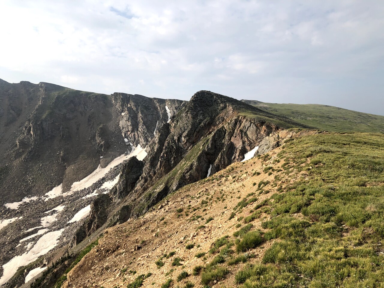
Devil's Thumb Lake (~ 12 miles)
Devil's Thumb Trail starts the same as the two above routes. However, at the first intersection you get to — around mile 1.3 — take the right toward the Devil's Thumb Bypass. If you reach the turn for King Lake, you have gone too far.
To reach the lake, you'll hike about 6 miles and gain about 2,000 feet in elevation. The scenery is beautiful along the way, so this is also a great trail if you want to build a shorter out-and-back route.
And if you want a longer day, you can keep hiking beyond the lake up to the Continental Divide, which, of course, carries the Continental Divide Trail. This is about one extra mile.
High Lonesome Loop (~ 16 miles)
Looking for a longer day? The High Lonesome Loop has it all (as does the lesser-explored Junco Lake Loop just north of High Lonesome).
This 16-mile loop, which gains about 3,000 feet, includes beautiful single-track trails, campsites, streams, alpine lakes, wildflowers and a ridgeline section on the Continental Divide.
This route is generally an uphill climb for the first half.
If you're headed clockwise, take the Devil's Thumb Trail to the Devil's Thumb Bypass Trail (about 1.3 miles from the trailhead) and follow it for about 7 miles until you're on the top of the Continental Divide. Be aware that snow sometimes clings to the top of this trail and can be dangerous in the spring.
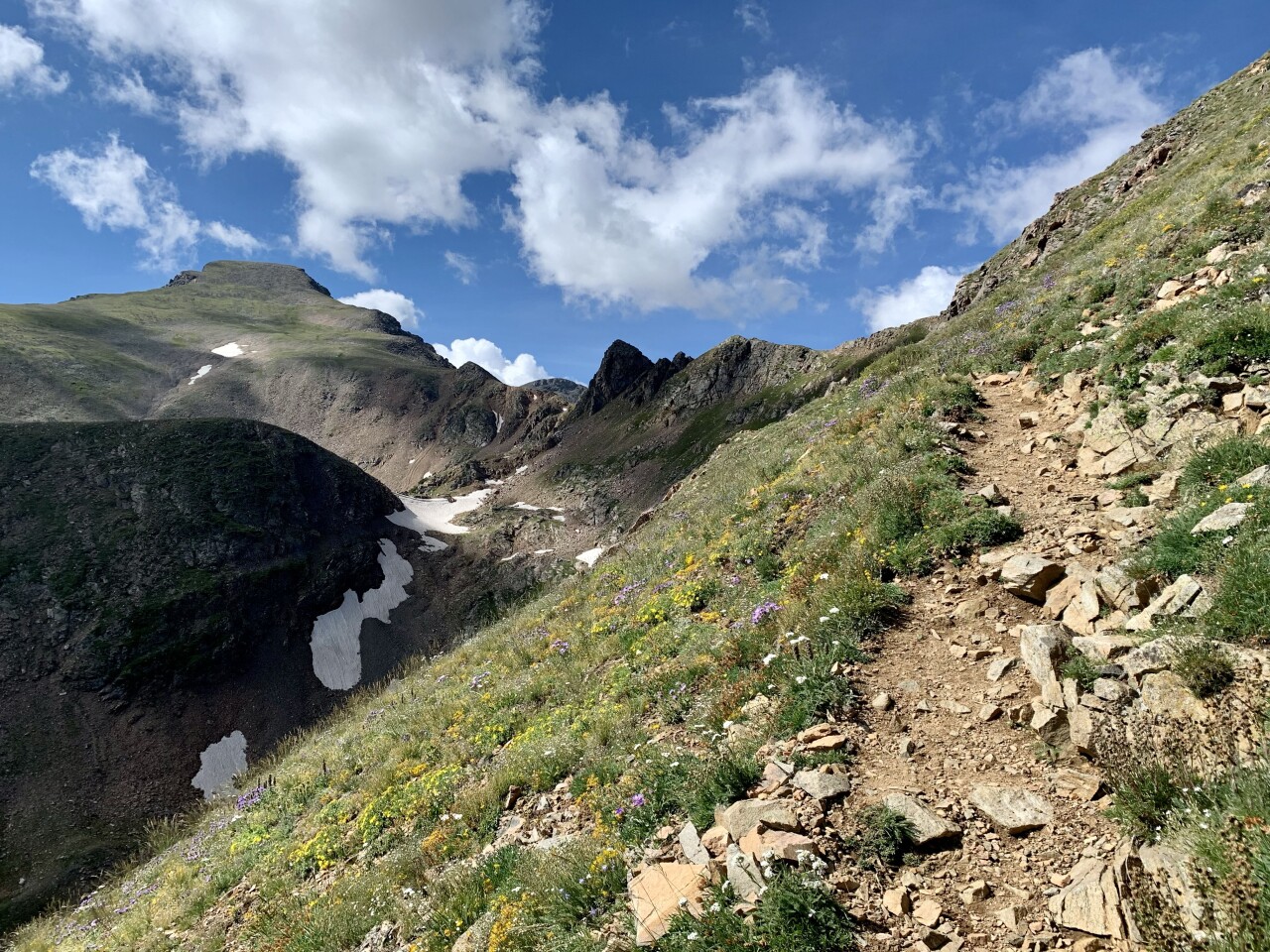
The CDT will curve south toward Rollins Pass, but you will dip back down before reaching it to go by King Lake. Take the trail back downhill to the trailhead.
This is a popular option for trail runners and backpackers. There is a long list of connecting trails to explore off of this loop, including Rollins Pass, Diamond Lake and Forest Lakes.
Have an outdoor recreation story for Denver7? We'd love to hear from you. Contact Stephanie Butzer in the form below.
