


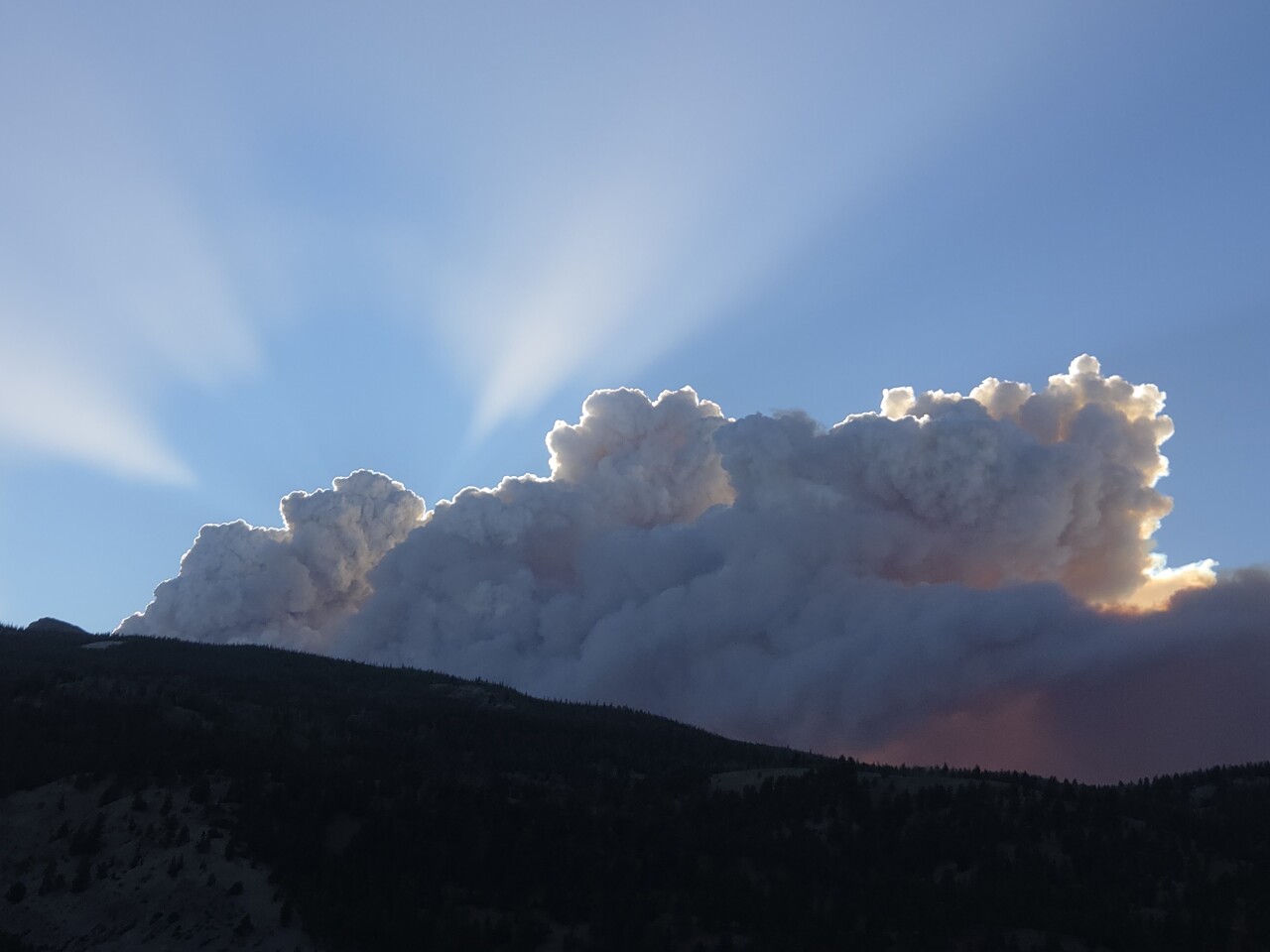
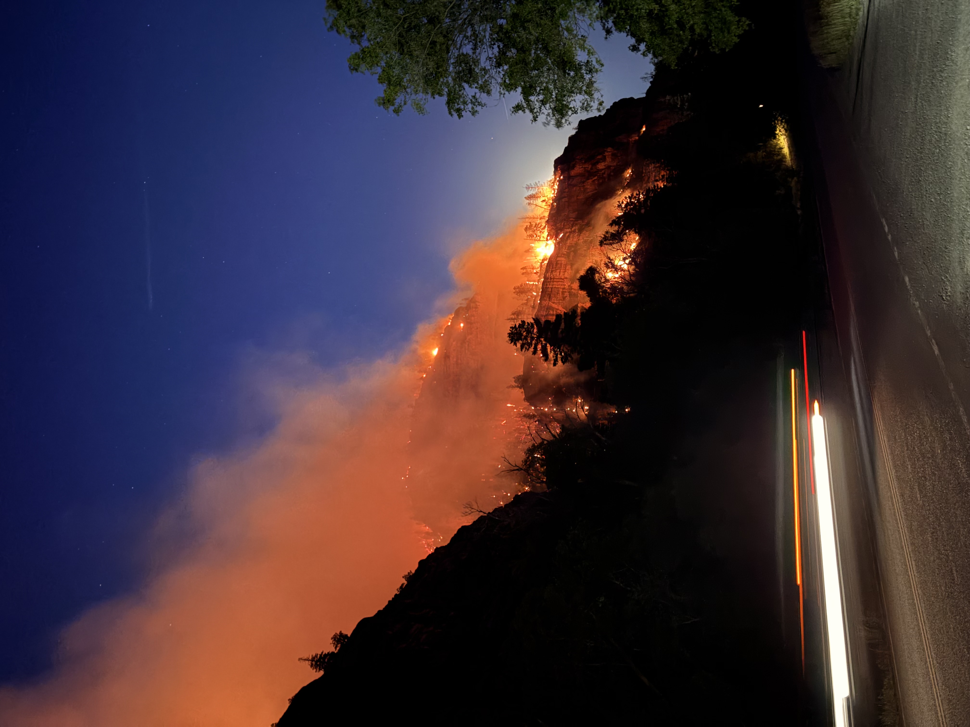
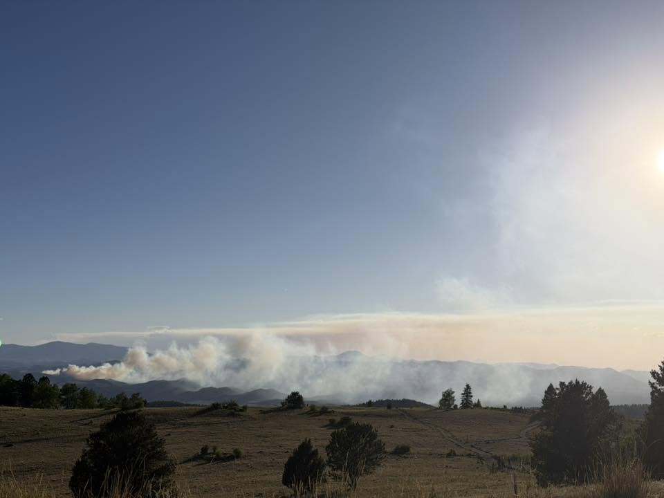
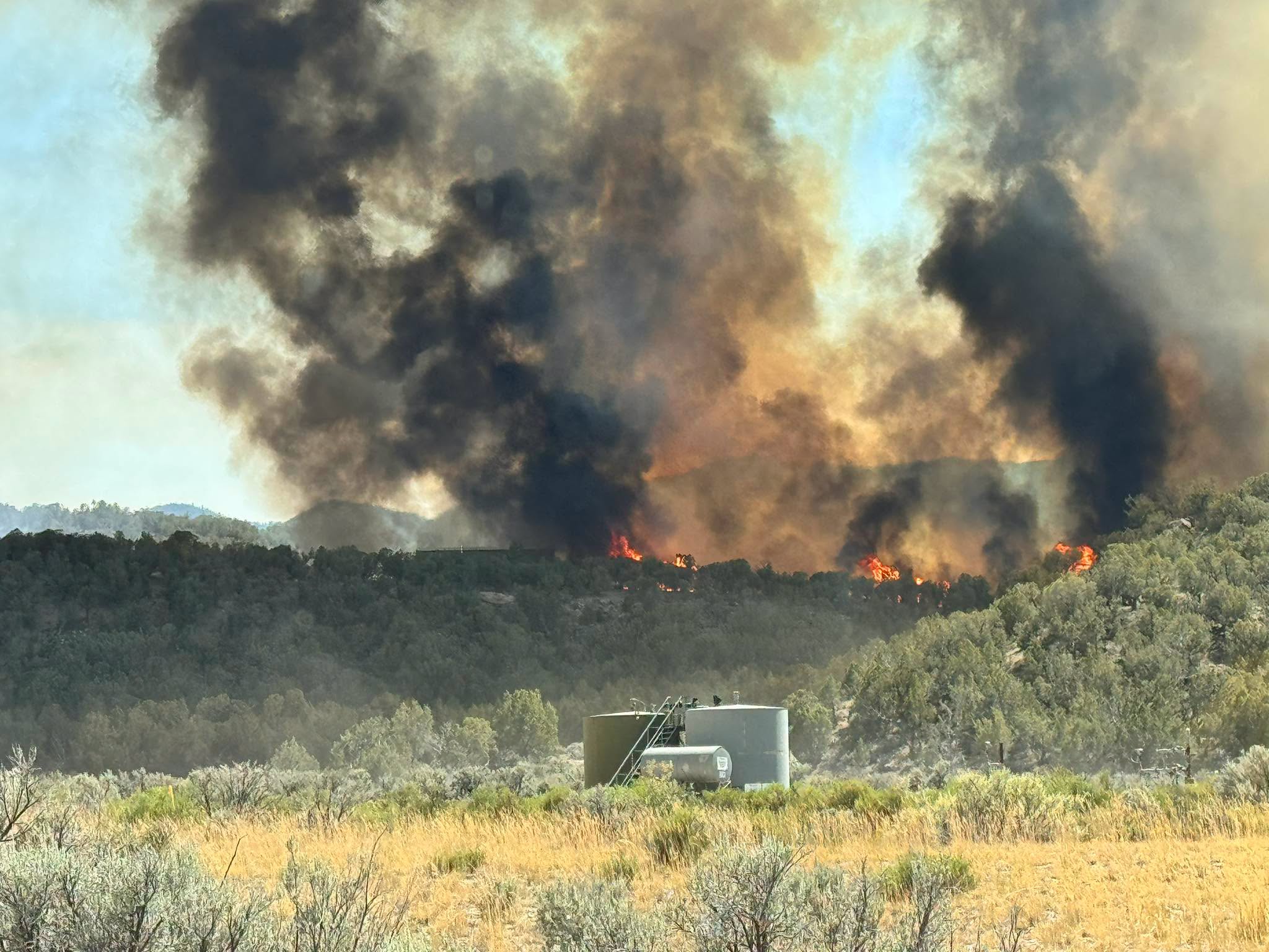
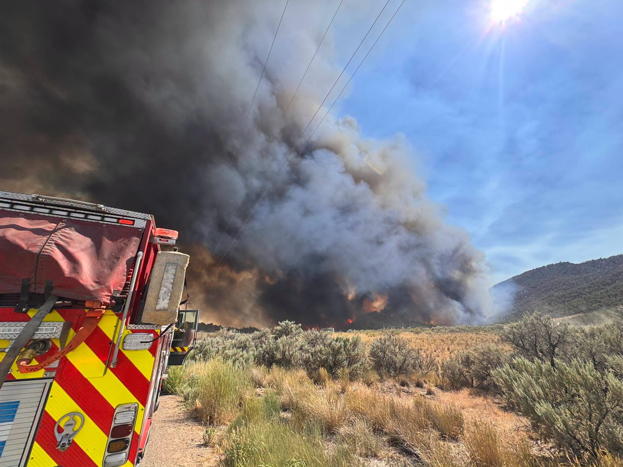
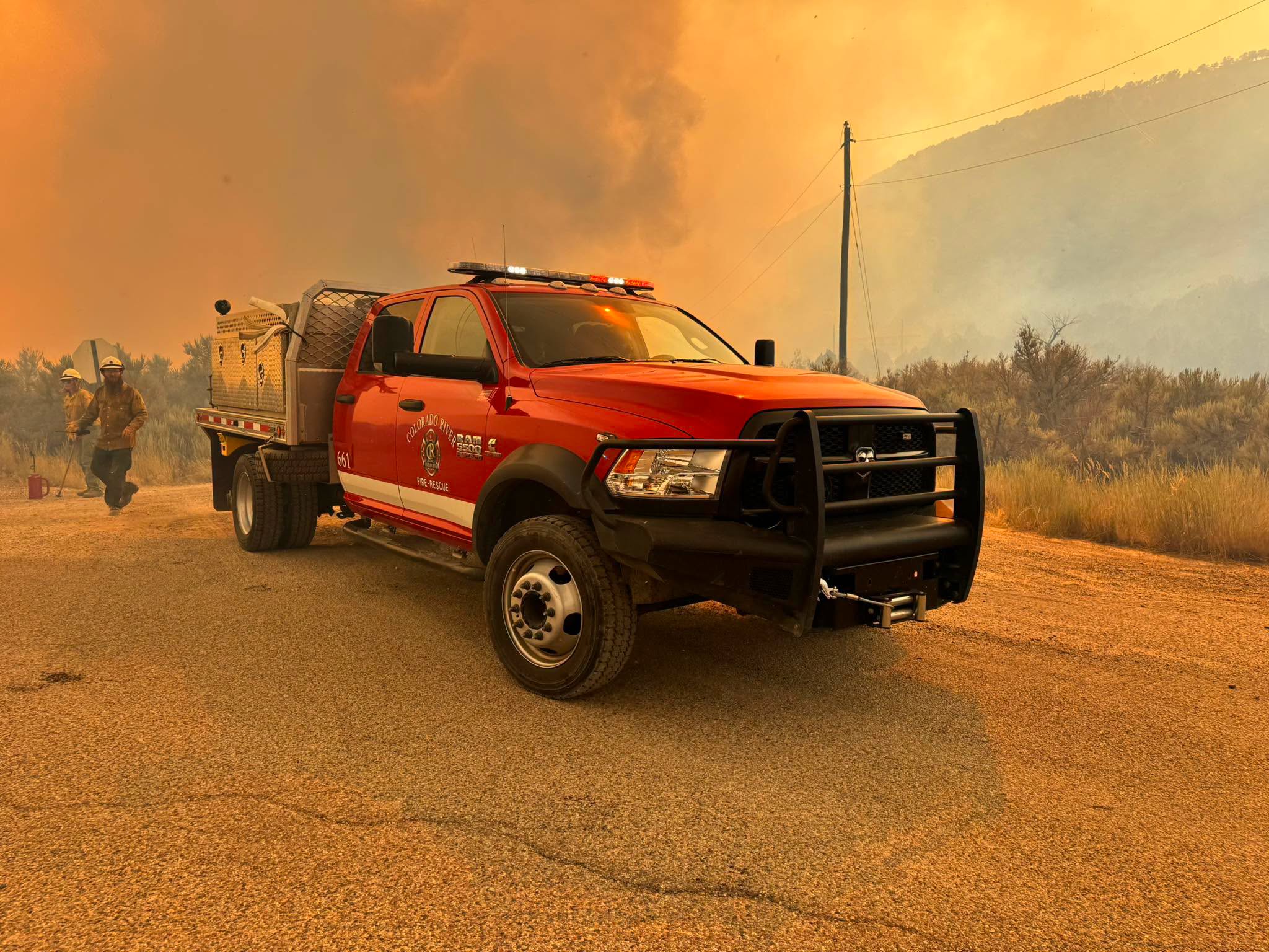
Multiple large and fast-moving wildfires are burning on the western side of Colorado, forcing evacuations, closures and sending plumes of smoke into the air and across the state.
Denver7 is tracking the latest on each and has crews working to learn more about these destructive fires. Colorado Gov. Jared Polis has verbally declared disaster emergencies for several of these fires, which authorizes more resources to help with containment and protecting communities.
The National Weather Service is reporting that warm and dry air will coincide with gusty west and southwest winds on Monday and Tuesday, which could possibly continue through Friday. Sustained winds are expected to reach 15-30 mph in the high country, with gusts up to 45 mph.
"These conditions will drive very high fire danger across the warned area. Any new starts or established fires will likely spread rapidly under these conditions," the NWS said.
All of the below information on Colorado's wildfires will be updated as we learn more.
Snyder Fire/Snyder Mesa Fire
- 📍Mesa County on Colorado-Utah border
- Size: 28,264 acres (as of Monday, 2 p.m.)
- Containment: 0% (as of Monday, 2 p.m.)
- Start date: Late June 26 or early June 27
- Cause: Lightning

All flags on state buildings will fly at half-staff on Monday to honor the three firefighters who died fighting the Snyder Mesa Fire, also called the Snyder Fire, which is burning in Mesa County on the Utah-Colorado line. They have been identified as Emily Barker, 38, of Michigan, Nick Hutcherson, 27, of Arizona, and Sydney Watson, 27, of Alabama. Two other firefighters were injured.
Colorado Gov. Jared Polis verbally declared a disaster emergency in response to this fire on Saturday, June 27.

The Snyder Fire merged with the Jones Fire, and then overtook the Knowles Fire and Gore Fire. Because they have combined, this blaze is known as the Snyder Fire.
Emergency closures are in place at Horsethief State Wildlife Area and Loma Boat Launch State Wildlife Area. Anybody floating the Colorado River is asked to end their trip at the Fruita boat ramp, as there are no river takeout points between Fruita and the Utah state line.
The Red Cross evacuation resource center is open at Grand Junction High School (GJHS) until 8 p.m. Monday.
Gold Mountain Fire
- 📍Ouray County
- Size: 7,103 acres (as of Monday, 2 p.m.)
- Containment: 0% (as of Monday, 2 p.m.)
- Start date: June 27
- Cause: Tree fell on a power line

Ouray County declared a state of emergency on Sunday, June 28 for the Gold Mountain Fire, which originated on U.S. Forest Service land. The fire has been "very influenced by the land," the county said, and is burning in extremely steep and rugged terrain.
According to Watch Duty, the fire has burned 7,103 acres as of 2 p.m. Monday.
Multiple fire crews — both on the ground and in the air — were ordered to assist. A USFS fire investigator responded to this wildfire to work to determine the cause. According to the Ouray County Sheriff's Office, the fire started after a tree fell on a power line.
Evacuations are currently in place for:
- Lake Lenore and Panoramic Heights areas
- Redstone Road
- Peck’s Trailer Park
- Cedar Hill Cemetery, east of Highway 550
- Anybody recreating in the area of Cow Creek on U.S. Forest Service land past the intersection of County Road 12
A pre-evacuation notice is in place from Whispering Pines to Black Lake neighborhood along County Road 17, according to the county.
An evacuation center has been set up at the Ridgway Secondary School, located at 1200 Green St. in Ridgway.
As of 10 a.m. Sunday, no structures were lost.
A two-mile stretch of Highway 550 is closed north of Ouray due to this fire. Only local residents are allowed to use County Road 17. All other traffic must go to Highway 145 through Telluride.
The City of Ouray is not under evacuation notice as of now, but a cell tower may have been damaged by the fire, resulting in limited service in the small community.

Colorado Gov. Jared Polis verbally declared a disaster emergency in response to the Gold Mountain Fire on Sunday.
There is no current threat to Ridgway State Park, which remains open to visitors.
Willow Fire
- 📍Lake County, west of Leadville
- Size: 1,200 acres (as of Monday, 12:20 p.m.)
- Containment: 0% (as of Monday, 12:20 p.m.)
- Start date: June 28
- Cause: Unknown

On Sunday afternoon, the Lake County Office of Emergency Management announced evacuations for the Willow Fire, burning on U.S. Forest Service land in the Twin Mounds area below Mount Massive.

Mandatory evacuations are in place for the following locations:
- County Road 4, 9, 9D, 5A, 48, and 99
- All trails from the Fish Hatchery
- All campgrounds around Turquoise lake
- All trails up to treeline
- Colorado Trails sections in this area
- Hagerman Pass
Pre-evacuation orders apply to homes in the Grand West area, Mountain View East and West, Turquoise Lake Estates, Silver Hills Subdivision, and homes on County Roads 9, 17, and 4. Leadville proper is not under any evacuation orders.
At 9:29 a.m. Monday, the Lake County Office of Emergency Management said there were no major updates overnight.

Multiple roads are closed in the area for first responders, including Turquoise Lake Road, Highway 300 at County Road 5 and County 5A (Fish Hatchery Loop), County Road 9 and County 99 intersection (Leadville Junction), and County Road 4 and County Road 48 (Turquoise Lake Dam entrance).
Large animals can be brought to the rodeo grounds on McWethy Drive.
Colorado Gov. Jared Polis verbally declared a disaster emergency for this fire on Monday morning.
Aspen Acres Fire
- 📍Custer County
- Size: 2,476 acres (as of Monday, 11:59 a.m.)
- Containment: 0% (as of Monday, 11:59 a.m.)
- Start date: June 29
- Cause: Unknown

The Pueblo County Sheriff's Office reported on Monday morning that several fire agencies are responding to a wildfire near Aspen Acres in Custer County. This is about 15 miles northwest of Colorado City.
The fire is moving north and west to 12 Mile Road, the Custer County Sheriff's Office reported Monday morning.

Residents from Aspen Acres on Highway 165 to Old San Isabel Road were told to evacuate, as well as anybody in the area of Lazy Acres and Bishops Castle. The evacuation order later expanded to anybody within a five-mile radius of Aspen Acres, as well as the entire community of Beulah. As of 1:20 p.m. Monday, the area south of Highway 96 and Highway 165 to the Pueblo County line was also under evacuation order.
An evacuation center is set up at the Pueblo County Recreation Center, located at 1650 Cooper Place. Pets are permitted.
Highway 165 is closed from Highway 78 to the Pueblo County line at lake Isabel.
No structures are threatened as of 8:07 a.m. Monday. No injuries have been reported.

Aircraft were ordered and were en route, but the Custer County Sheriff's Office said they may need to cancel due to wind.
An evacuation site for large animals is set up at 4 Bar S, located at 6675 Highway 78.
Colorado Gov. Jared Polis verbally declared a disaster emergency for this fire on Monday morning.
The Custer County Sheriff's Office said a smaller fire has also broken out in the area near Isabel Lake. Denver7 is working to learn more about this wildfire.
Ferris Fire (includes Far Draw Fire & Doe Canyon Fire)
- 📍Montezuma and Dolores counties (Dolores Ranger District of the San Juan National Forest)
- Size: 17,000 (as of Monday, 1:55 p.m.)
- Containment: 0% (as of Monday, 1:55 p.m.)
- Start date: June 27
- Cause: All three suspected to have been started by lightning
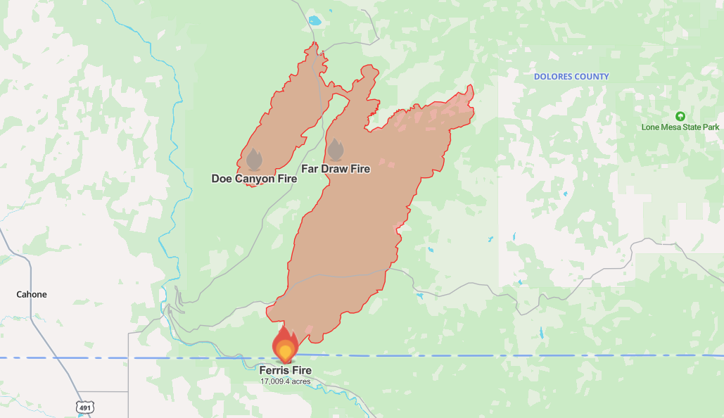
The Ferris Fire began burning in the canyon north of Road D in Montezuma County on Saturday. High winds are causing extreme fire behavior on Monday.
On Sunday, the Ferris Fire merged with the Far Draw Fire, and they are now both called the Ferris Fire. Because the Doe Canyon Fire is also very closed, all three fires are now being managed as the Ferris Fire.

Residents and visitors in the area, as well as along the Lone Dome Road and Bradfield Campground, were evacuated on Saturday. The campground down Highway 504 to the McPhee Dam is under evacuation orders.
Anybody who evacuated is welcome to come to the Pleasant View Fire Station at 15235 Road CC.

A fire area closure is in effect, which runs about 30 miles northwest of Dolores and 10 miles east of Cahone. The public is not permitted within this area.
In a Monday afternoon update, Toby Cook, operations section chief with San Juan Team 8, said they got dozer lines on part of the northwest section and put fire retardant around the Glade Ranch subdivision northeast of the fire. The southern part of the fire has been quiet, Cook said.
11 Fire
- 📍 Fremont County
- Size: 102.9 acres (as of Monday, 11:58 a.m.)
- Containment: 0% (as of Monday, 9:08 a.m.)
- Start date: June 28
- Cause: Unknown

The 11 Fire began burning on the morning of June 28 around High Park Road and County Road 352A Fremont County.
Evacuations have been ordered for anybody within a 1.25-mile radius of the fire. Anybody who has been evacuated can go to Pathfinder Park or Teller County Fairgrounds for help, the Fremont County Sheriff's Office reported.
County Road 69 and County Road 11 (High Park Road) northbound are closed. County Road 11 southbound is closed at milemarker 10.
Firefighters have been preparing for strong winds on Monday.
The Bureau of Land Management has assumed control of this incident.
Dry Creek Fire (fully contained)
📍 South of Rifle
Size: 316 acres
Containment: 100%
Start date: June 23
Cause: Unknown
The Dry Creek Fire, which started burning on June 23, is fully contained.
All evacuation orders were lifted on June 28 as of 8 p.m., according to Watch Duty.
▶️Denver7 took a look at the reality of year-round wildfires in our special "Burned Out" in November. Watch it below and read our in-depth story here.