


DENVER – Destructive hail the size of tennis balls, damaging winds and possible tornadoes are likely as strong to severe storms move across the far northeast portion of the state Tuesday afternoon and evening, according to forecasters with the National Weather Service (NWS) in Boulder.
A severe thunderstorm watch is now in effect until 10 p.m. for all of northeast Colorado, and includes areas along and east of I-25, weather service officials said just after 2:30 p.m. Tuesday.
A severe thunderstorm watch has been issued for parts of Colorado, Kansas, Nebraska and Wyoming until 10 PM MDT pic.twitter.com/UyxGPSDFdA
— NWS Boulder (@NWSBoulder) August 8, 2023
The first round of storms will bring high-based showers and storms across the northern foothills before pushing east to the plains along the Wyoming/Colorado border between 3 p.m. and 7 p.m. A possible second round could occur if between 8 p.m. through midnight that could bring heavy rain to the region. The highest threat for severe storms are likely to occur from Fort Morgan to Limon, pointing east, according to NWS officials.
The northeast plains will be “under the gun for severe storms and potentially very large, destructive hail and high winds,” forecasters said in their latest forecast discussion.
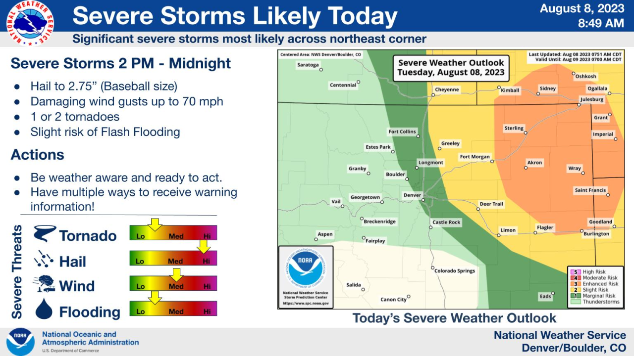
“Parts of northern Weld, Morgan, Washington, Logan, Sedgwick and Phillip will be the main areas for tennis ball-sized hail, 65 mph winds, lightning, and possibly a brief tornado,” weather officials wrote, adding they would not be surprised if storms continued through midnight near the Kansas/Colorado border.
In the Denver metro, the chance for this system to produce severe weather is marginal, with areas along the I-25 Corridor more likely to produce just gusty winds and light rain, forecasters said.
Skies should clear overnight and highs will be in the upper 70s to mid-80s across the I-25 Corridor and the plains on Wednesday, with temperatures returning to normal conditions for this time of year.
The chance for scattered afternoon and evening storms for our area returns this weekend, officials said.
