


DENVER — Unsettled weather will return to Colorado Tuesday evening through Thursday with snow along the Continental Divide and strong winds across the foothills and eastern plains.
Temperatures on Tuesday across the eastern plains will stay relatively mild, with highs into the 60s, according to the National Weather Service (NWS).
Along the higher areas of the Front Range, foothills and the mountains, strong west winds between 30 to 45 mph could reach peak gusts of 85 mph by the evening hours. A high wind warning is in effect from 8 a.m. to 8 p.m. Tuesday for Rocky Mountain National Park, the Medicine Bow Range, Indian Peaks, foothills and Front Range.
Damaging winds that could blow down trees and power lines, local power outages and difficult travel are possible, especially for high-profile vehicles, the NWS said.
In addition to the warmer temperatures, winds will be a main concern across the state on Tuesday. The NWS said high-resolution models show "very strong winds, possibly gusting up to 90 mph" in the foothills. Some of those gusts may move onto the adjacent plains by Tuesday afternoon, and Boulder could see gusts up to 65 mph.
This combination of gusty winds and warm conditions will bring elevated fire weather concerns, the NWS said.
A red flag warning will go into effect from 11 a.m. to 5 p.m. Tuesday for Pueblo County, Huerfano County, and Las Animas County. El Paso County was omitted from this warning because humidity levels will remain above 15%, but residents should still expect a gusty afternoon, the NWS said.
The NWS out of Grand Junction said a "series of systems" will begin to impact western Colorado Tuesday through the end of the year. This prolonged winter storm will bring moderate to heavy snow at higher elevations and some valleys, the NWS reported.
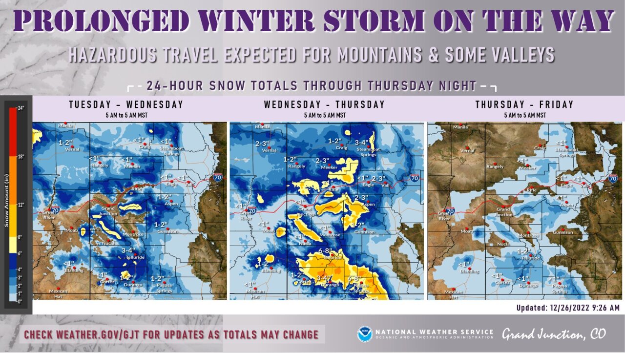
The storm will start with increasing winds out of the southwest on Monday evening, which will result in gusty conditions on Tuesday. On Tuesday evening, precipitation will increase, bringing mountain snow and valley rain across the western half of the state.
A winter storm watch was issued beginning Tuesday evening for the eastern San Juan Mountains, where 1 to 2 feet of snow is possible. The La Garita Range and Central Mountains will see 4 to 8 inches of new snow starting Tuesday evening through Thursday, according to the NWS.
This snow will create slick roads and poor travel conditions in the mountains.
By Wednesday evening, temperatures will dip enough that the rain in the valleys will turn to snow. Still, this system will not be particularly cold, the NWS reported.
As for the mountains, the NWS said confidence is increasing that they will receive a significant amount of snowfall.
"Early indications show that amounts as high as two feet are not out of the question," the NWS reported.
Light snow is possible across the eastern plains on Wednesday night into Thursday morning.
The precipitation will decrease throughout Thursday as the system continues to move over the plains.
Another system is possible for the weekend in the mountains, but the eastern plains will stay dry.

MORE: Hourly forecast | Latest forecast | Radars | Traffic | Weather Page | 24/7 Weather Stream
Stream live current temperatures, plus radars, across Colorado anytime for free: Weather 24/7 streaming on the free Denver7+ app on your TV or watch on your computer or mobile phone anytime.