Denver - Tuesday, temperatures topped out in the 60s over the plains under a mix of sun and clouds. Tonight, a moist storm system will move into southwestern Colorado, changing our mild weather pattern dramatically.
This storm will drop heavy snow over the Southwest and Central mountains tonight through early Friday, with 1 to 2 feet of snow possible. This is some very welcome moisture for those mountain areas, which have been quite dry.
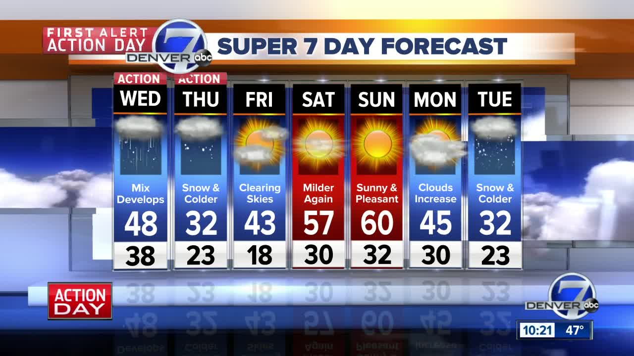
Denver and the Front Range will turn colder around midday, with rain developing in the afternoon. Highs will be in the upper 40s Wednesday and winds will be strong from the north in the afternoon. The rain showers will mix with snow in Denver and along the I-25 Corridor tomorrow evening as lows drop to the 20s.
The roads will likely be wet for the Wednesday night commute and then the rain will switch over to snow during the evening. The Thursday morning commute will likely be the worst for Denver and the Front Range with a few inches of snow and much colder temperatures.
Highs on Thursday in Denver will be much colder, in the low to mid-30s. Snowfall will not be excessive for the Denver metro area - likely in the 2 to 4 inch range.
Friday will start out cold with lows in the teens. Sunshine will boost temperatures back to 50 degrees in the afternoon.
Next weekend will be mild and dry with highs in the upper 50s to low 60s.
A new storm system will impact Colorado during the week leading up to Thanksgiving.


