


Our official high for Denver on Friday was 59 degrees at DIA. Our average high this time of year is 43 degrees.
Our weather changes begin on Saturday with a rain/snow mix possible by Saturday evening. Highs will climb into the upper 40s and low 50s this afternoon.
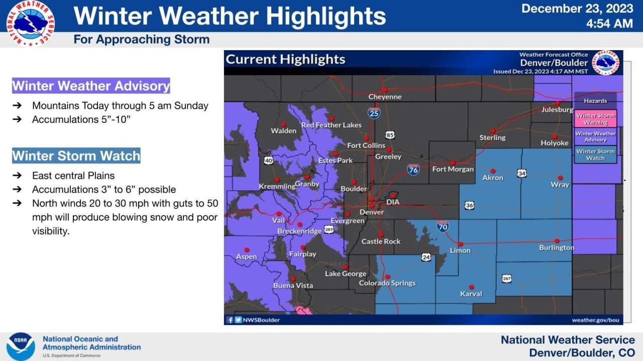
The mountains will see snow pick up in intensity Saturday into Sunday with treacherous travel at times. Southwestern Colorado will see heavier snow, with Winter Storm Warnings and Winter Weather Advisories in effect through Sunday.
Fresh powder is in store for our northern and central mountains as well— great news for skiers and boarders hitting the slopes for the holiday weekend.
In Denver, expect cold and blustery conditions on Christmas Eve. Bundle up and be prepared for snow showers through the Broncos game on Sunday evening.
A winter storm watch was in place for much of the eastern plains down to Colorado Springs.
In its forecast discussion updated early Saturday, the National Weather Service in Boulder said an inch or two of snow was possible in across the Denver metro through Sunday with higher totals in the foothills and along the Palmer Divide.
"Although the main event as far as snowfall is concerned will likely be ending by daybreak Sunday, the trailing edge of the snow may still be impacting portions of the eastern plains, particularly during the morning hours," the discussion read.
Skies gradually clear on Christmas Day with temperatures staying chilly in the upper 30s.
Drier weather will settle in for the rest of next week. We will see partly cloudy skies with highs near 50 degrees.
LEARN MORE: Hourly forecast | Radars | Traffic | Weather Page | 24/7 Weather Stream
Click here to watch the Denver7 live weather stream.
