


DENVER — A colder and wetter weather pattern begins today as a strong cold front passes through Colorado.
Snow is falling in the mountains and winds will be very strong across the plains. Six to ten inches of snow will be likely for the mountains of northern and central Colorado above 10,000 feet.
- Check Denver7 Weather's hourly forecast
- Track rain, snow with Denver7 Weather's Interactive Radar
A few showers will be possible this evening in Denver- possibly mixed with light snow overnight.
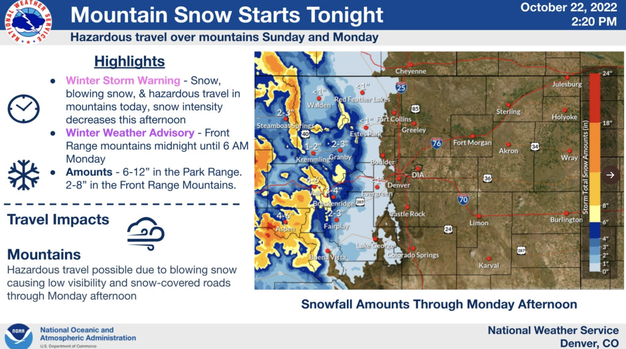
The storm will not be a big one for the Denver area, but there will be a chance of some light snow Sunday night and early Monday - probably not enough to mark the first official snowfall of the season - little to no accumulation is expected. However, temperatures will be cold tonight, with a hard freeze expected.
A Freeze Warning will be in effect tonight through 9 a.m. Monday for the Denver area as temperatures to around 27 degrees by morning.
The average date for the first official snow (at least one tenth of an inch) is October 18. Last year, the first official snowfall was not until Dec. 10 - the latest on record since 1882. In 2020, the first snowfall was on Sept. 8. The earliest snowfall was Sept. 3, 1961.
Monday will be chilly with highs only in the upper 40s to low 50s. Skies gradually clear.
Tuesday and Wednesday will stay cool with highs near 60 degrees which is closer to average for this time of year.
Thursday, our next front will usher in cooler air and the chance for showers.
Click here to watch the Denver7 live weather stream.
Click here to watch the Denver7 live weather stream.
